
As the author of "Fort Cumberland", Lannie Dietle has written the most consequential western Maryland history book since Thomas and Williams' 1923 book "History of Allegany County, Maryland".
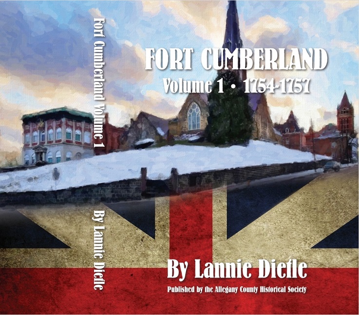
The pictured church building is the Emmanuel Episcopal Church (a.k.a. "Emmanuel Parish") of Cumberland, Maryland, which was built in the mid-1850s. It sits on the former site of the palisaded barracks portion of Fort Cumberland, on a hill adjoining Wills Creek and the Potomac River, and has its own interesting history. Storehouses erected by the Ohio Company of Virginia were on the opposite side of the river in Virginia. Fort Cumberland was hastily erected in 1754 to serve as the jumping off point for General Edward Braddock's disastrous 1755 military campaign against Fort Duquesne (Pittsburgh, Pennsylvania) during the French and Indian War. Originally made from puncheons, the palisades of Fort Cumberland were eventually reinforced with thick earthworks to provide protection against cannon fire. The western end of the fort was armed with four pounder ship cannons mounted in bastions.
Fort Cumberland was used as a place of refuge for pioneer settler families during Pontiac's War and was abandoned as a military outpost in 1765. As the fort lost its military significance and deteriorated, the general location was gradually emerging as a populated place and a commercial center. Fort Cumberland was used as a supply depot during the Revolutionary War, and as a camp site and a storage location for excess equipment during the Whiskey Rebellion. In the 1780s the place was formally constituted as a town — a town that was sometimes referred to by the name Fort Cumberland as late as 1817.
The book "Fort Cumberland" was written in pursuit of two objectives. The first was to document the history of Fort Cumberland and its environs before the town was officially established — including pioneer settlement activities before and during the French and Indian War. The second objective was to examine the cause of the French and Indian War from a broader perspective than Will H. Lowdermilk provided in his 1878 book "History of Cumberland (Maryland)..." Click here for an overview of the content of the "Fort Cumberland" book.
Other photographs of the Emmanuel Episcopal Church are included farther below, along with a photograph of a tunnel at the east end of the church that is thought to be a surviving fragment of old Fort Cumberland.
As the author of "Fort Cumberland", Lannie Dietle has written the most consequential western Maryland history book since Thomas and Williams' 1923 book "History of Allegany County, Maryland".
![]()
All proceeds benefit the Allegany County Historical Society of Cumberland, Maryland.
Individuals with Kindle accounts can read the Kindle edition of the book using the Kindle Cloud Reader website, using the Kindle app on a phone, tablet, or computer, or using a Kindle e-reader device.

The Emmanuel Episcopal Church sits on the site of the east end of the barracks portion of Fort Cumberland.
The hill where the fort was located overlooks and adjoins Wills Creek and the Potomac River.

This tunnel at the east end of the Emmanuel Episcopal Church is thought to be a surviving part of the fort.

![]()
![]()
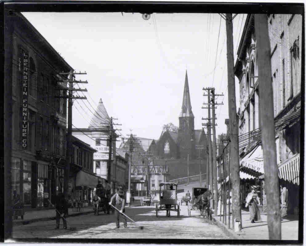
This old photograph was taken looking west toward Emmanuel Episcopal church from the east side of Wills Creek. It shows the elevation of the site of Fort Cumberland relative to the ground on the east side of the creek (Photo courtesy of Mike McKenzie).