
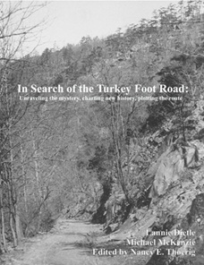
Although I had research and editing assistance from others when writing the book, the mistakes are entirely my own. Having been so new to writing history, I still had a lot to learn about my limitations as a historian. The result was four editions of the book. Each new edition was written to address interpretive mistakes in the previous edition — such as antecedent route mistakes — and to add new material.
I thought the fourth edition (2014) eliminated all the antecedent route mistakes, but I was wrong. Shortly after publication, I realized that my interpretation of a dashed line route on the 1755 version of the Fry and Jefferson map was incorrect. Although it was exhilarating to discover that the dashed lines were a schematic representation of Christopher Gist's second Ohio Company tour, it's embarrassing that the fourth edition indicates that the dashed lines probably represent an Indian path antecedent to the Turkey Foot Road.
In 2015, I corrected that dashed-line interpretive mistake in a pdf-based addendum that few people will probably take the time to read. This internet-based copy of the fourth edition incorporates annotations that call attention to that mistake and a few others. I am taking this approach because the limitations imposed by the infirmities of old age make the task of rewriting the book seem impossibly daunting.
I wish the route-related chapters of the book could have been organized to present the route in linear fashion, from east to west. Instead, the route is presented more or less in the jumbled order and direction the route-related research was performed — and that was plenty difficult enough. I knew virtually nothing about the road when the research commenced, and I truly was "In Search of the Turkey Foot Road".
L. Dietle
Be sure to see the associated video tour and interactive map of the Turkey Foot Road!
The annotations were incorporated using the pdf comment function, and the comments are attached to yellow-highlighted text. Be sure to read the book using a browser that supports the comment function. For what it's worth, the browsers on my computer all support the comment function, but the browsers on my iPhone do not.
Front Matter ※ This is typical front matter: The cover, the title page, the copyright page, the dedication, the epigraph, the table of contents, the authors' preface, the editor's preface, and acknowledgements. The third page of the authors' preface provides an overview of the evolution of the book.
Chapter 1: Introduction ※ This chapter, which is flawed by my misinterpretation of the 1755 Fry and Jefferson map, provides a general overview of the book, including a summary of the route and Revolutionary War origin of the Turkey Foot Road.
Chapter 2: The Indian and bridle path traditions ※ This chapter presents traditions that the Turkey Foot Road began as an Indian foot path and subsequent bridle path.
Chapter 3: Gist's journal indicates that a packer's path followed Jennings Run in 1751 ※ Based on Christopher Gist's July 16, 1751 journal entry, this chapter claims that an early trading path followed the Jennings Run water gap. In light of my mistaken interpretation of the dashed lines on the 1755 Fry and Jefferson map, I have spent hours unsuccessfully trying to disprove the logic that produced the claim made by this chapter.
Chapter 4: The Fry and Jefferson map shows a path from Wills Creek to Turkeyfoot, and beyond ※ The overall conclusion of this chapter — that the dashed lines east of the Monongahela River on the 1755 Fry and Jefferson map may illustrate an antecedent to a portion of the Turkey Foot Road — is incorrect. Instead, as detailed in Addendum A, the dashed lines on the 1755 Fry and Jefferson map illustrate Christopher Gist's second Ohio Company tour.
Chapter 5: Before the Ohio Company road, early trade out of Wills Creek angered the French ※ This chapter refutes Alfred Thomas Goodman's belief that the Twightwee Indians built a road eastward from Pickawillany to Wills Creek to facilitate trade with the English, and scrutinizes Charles Greve's assertion that a significant level of Pennsylvania trade passed through Wills Creek enroute to the forks of the Ohio. This chapter also confirms that traders were already taking Ohio Company goods deep into the Ohio valley before Christopher Gist even began looking for a suitable location for the Ohio Company road, and before the June 21, 1752 attack on Pickawillany.
Chapter 6: Contrary to conventional wisdom, the Ohio Company did not cut the Turkey Foot Road ※ This chapter and chapter 9 refute Paul A. W. Wallace's belief that the Ohio Company created the Turkey Foot Road.
Chapter 7: Why the Ohio Company and Braddock did not use the Turkey Foot Path ※ The Ohio Company's road was the only wagon road leading westward from Wills Creek in 1755.
Chapter 8: The circa 1775 Leibundgutt traditions ※ This chapter attempts to evaluate a Turkey Foot Road-related statement that appears in the introduction to a 1991 book.
Chapter 9: Colonel Morgan's 1779 road to Pittsburgh ※ This is a groundbreaking chapter that identifies the military origin of the Turkey Foot Road, which was cut in 1779 to facilitate the resupply of Fort Pitt in support of and enabling Brodhead's successful expedition.
Chapter 10: Reconciling Veech, Morgan, and tradition ※ This chapter provides an overview of how Indian foot paths evolved into bridle paths and wagon roads.
Chapter 11: Washington's correspondence mentions the new Turkey Foot Road ※ This chapter examines 1780s letters and journal entries that reference the new Turkey Foot Road and compare it favorably to Braddock's Road.
Chapter 12: The circa 1745 to 1801 path from Cumberland to Jennings Run, and northward ※ This chapter examines early references to the old Indian war road that followed the west side of Wills Creek.
Chapter 13: Doctor Wellford's 1794 travel journal ※ This chapter illuminates the portion of Dr. Robert Wellford's journal that documents his eastwardly 1794 journey on the Turkey Foot Road.
Chapter 14: The west side of the Allegheny Mountain ※ This chapter traces the route of the Turkey Foot Road down the western slope of the Allegheny Mountain toward Salisbury, Pennsylvania using early surveys, maps, aerial photos, local traditions, and fieldwork.
Chapter 15: The east side of the Allegheny Mountain ※ This chapter documents the route of the Turkey Foot Road on the eastern side of the Allegheny Mountain using early maps, surveys, aerial photos, and local traditions to trace route variations over time.
Chapter 16: Linking to the Bald Knob Road ※ This chapter identifies the route that crossed over Savage Mountain between the Greenville Road and Bald Knob Road.
Chapter 17: The 1804 route above Mount Savage ※ This chapter examines the 1804 route of the Turkey Foot road between Archibald Arnold's residence and the Mason-Dixon line.
Chapter 18: The route through Corriganville ※ This chapter traces the Turkey Foot Road through present day Corriganville and references associated historic items including Ninian Cochran's store, the long lost Devil's Backbone formation, the Warriors Path, and Indian Will's cove.
Chapter 19: The Hays Mill Path shared part of the route ※ At a minimum, the Hays Mill Path and the Turkey Foot Road followed a shared route between the locations of Corriganville and Cumberland. They may have also shared a route between Barrelville and Corriganville.
Chapter 20: A Catholic church on the Turkey Foot Road ※ This chapter traces Catholic history at Arnold's Settlement along the Turkey Foot Road, beginning with the first Mass in 1793 by Rev. Stephen Theodore Badin at Archibald Arnold's home.
Chapter 21: The road came down to the valley near present-day Barrelville in 1793 ※ This chapter details the research required to determine the path of the Turkeyfoot road between Barrelville and Arnold's settlement.
Chapter 22: An 1827 road closure document ※ This chapter reveals the work involved in identifying a surviving section of the Turkey Foot Road that is located near Mount Savage, Maryland.
Chapter 23: The pre-1804 Bear Camp route theory ※ This chapter theorizes that an iteration of the Turkey Foot Road followed an antecedent to Bear Camp Lane to a location near Arnold's Brick House, and then took one of two still visible abandoned routes down to the Jennings Run valley near Barrelville.
Chapter 24: The later nineteenth century route directly out of Mount Savage ※ This chapter examines a portion of the iteration of the Turkey Foot Road that Jack Pyle of Salisbury, Pennsylvania identified for the historian Dr. Paul A. W. Wallace in 1962.
Chapter 25: The Somerset-to-Cumberland toll roads ※ Between Barrelville and Cumberland, the Somerset-to-Cumberland toll roads described in this chapter were an evolution of the Turkey Foot Road.
Chapter 26: ※ The early 1900s road from Cumberland to Mount Savage This chapter explores the "Legislative Road" antecedent to the portion of present-day Route 36 between Cumberland and Barrelville.
Chapter 27: The 1833 route through the Narrows ※ This chapter reflects on the route of the Turkey Foot Road in and near Cumberland — which would have been obliterated by subsequent road and railroad construction — and takes notice of the new 1833 route of the National Road through the Narrows.
Chapter 28: Nineteenth century maps ※ This chapter presents the relevant portions of various maps from 1800 to 1874 that illustrate the region traversed by the Turkey Foot Road.
Chapter 29: The route through the Salisbury area ※ This chapter reconstructs the path of the Turkey Foot Road through the Salisbury area using early maps, historical accounts, aerial photos, and local tradition, while also documenting early settlement activity and Indian village sites associated with the route.
Chapter 30: Salisbury to Negro Mountain ※ This chapter documents a 2010 field study with Harry Ringler, supplemented with early property surveys and maps, tracing the Turkey Foot Road and tradition-based trail variations between Salisbury, Pennsylvania and Negro Mountain.
Chapter 31: The proven northern route to Harnedsville ※ This chapter establishes the alignment of the Turkey Foot Road from the eastern foot of Negro Mountain to Harnedsville, Pennsylvania using property surveys and maps, confirming that the historic route evolved into modern road alignments.
Chapter 32: A review of southern route traditions ※ This chapter reviews evidence and local traditions regarding possible southern forks of the Turkey Foot Road, while noting that the evidence remains suggestive rather than conclusive.
Chapter 33: From Harnedsville to the Fayette County line ※ Drawing on old surveys, maps, and county histories, this chapter identifies alignments of the Turkey Foot Road from Harnedsville north through Ursina and onward to the Fayette County line.
Chapter 34: The route across Fayette County ※ This chapter presents what is known about the route of the Turkey Foot Road across Fayette County, Pennsylvania. Incorrect speculation about the route in Westmoreland County is addressed in Addendum A.
Chapter 35: Other nearby Turkey Foot Roads ※ This chapter explores other early roads to the Turkeyfoot region that bore the destination-based name "Turkey Foot Road".
Chapter 36: Backpedaling through history ※ This chapter corrects a first-edition map interpretation error.
Chapter 37: A roundabout route on the 1755 Evans map ※ This chapter evaluates a roundabout route between Fort Cumberland and Fort Bedford that is illustrated on the June 23, 1755 Lewis Evans map. An abrupt turn appears to be located in the general vicinity of present-day Berlin, Pennsylvania.
Chapter 38: The old Glade Road ※ This chapter provides an overview of the history and route of the old Glade Road between Bonnet's tavern and West Newton.
Chapter 39: A floating sensation ※ This chapter describes the transportation significance of early Connellsville and West Newton, and evaluates a transportation-related statement Franklin Ellis made in 1882.
Chapter 40: Fort Cumberland ※ Fort Cumberland began as a small stockade fort at Wills Creek named Fort Mount Pleasant that was subsequently enlarged with attached fortified barracks and various outbuildings.
Chapter 41: History of the Turkeyfoot region ※ This chapter covers the early history of the Turkeyfoot region by reproducing Chapter 4 from Volume II of the 1906 book "The History of Bedford and Somerset Counties..."
Chapter 42: In support of an Indian path antecedent ※ This chapter reviews evidence supporting local traditions that the Turkey Foot Road followed an earlier Indian path.
Chapter 43: Grandpa's hatchet ※ This summation chapter describes the Turkey Foot Road as an evolving transportation corridor rather than a single fixed path. Indian footpaths became pack trails, then primitive roads and modern highways whose alignments shifted over time, yet a thread of continuity remains. The road helped determine where ancestors lived and who they met and married, so it is both a historical artifact and an integral part of regional heritage.
Addendum A: Fourth edition errata & supplemental material ※ This addendum identifies and corrects several errors in the fourth edition of "In Search of the Turkey Foot Road," and provides supplemental information.
