
Introduction
Rummel is an unincorporated village in Paint Township of Somerset County, Pennsylvania that is located at the intersection of what is now Graham Avenue and Sugar Maple Drive. (That intersection is located at 40.21748698064333, -78.8091099077678.) This web page identifies three old-time schools at Rummel. The earliest of the three schools was located eastward of the aforementioned intersection, and the two subsequent schools were located west of the intersection.
L. Dietle

The school that was east of Spruce Street
An older school on Sugar Maple Drive
Dating the above photograph of the church and school
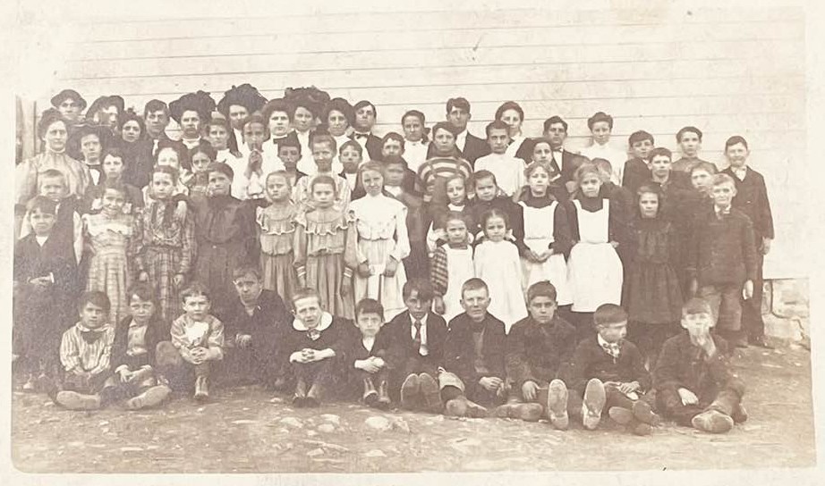
A 1909 school photo
A 1909 Rummel School record card
Students listed on the school record card
Maps relevant to the old schools on Sugar Maple Drive
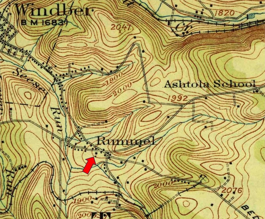
The following excerpt from a 1916 topographic map identifies the location of the Rummel school on Sugar Maple Drive. A school is illustrated in approximately the same location on the 1955 edition of a 1914 topographic map and on a 1944 topographic map. As will be shown below, by 1939 the plain-looking school building on Sugar Maple Drive had been replaced with a more elaborate structure.
The Rummel school was replaced by 1939
The following picture, which was provided by Patricia M. Durst-Shaffer, shows the replacement school building with the pyramidal roof.
Go to the Somerset County schools Index

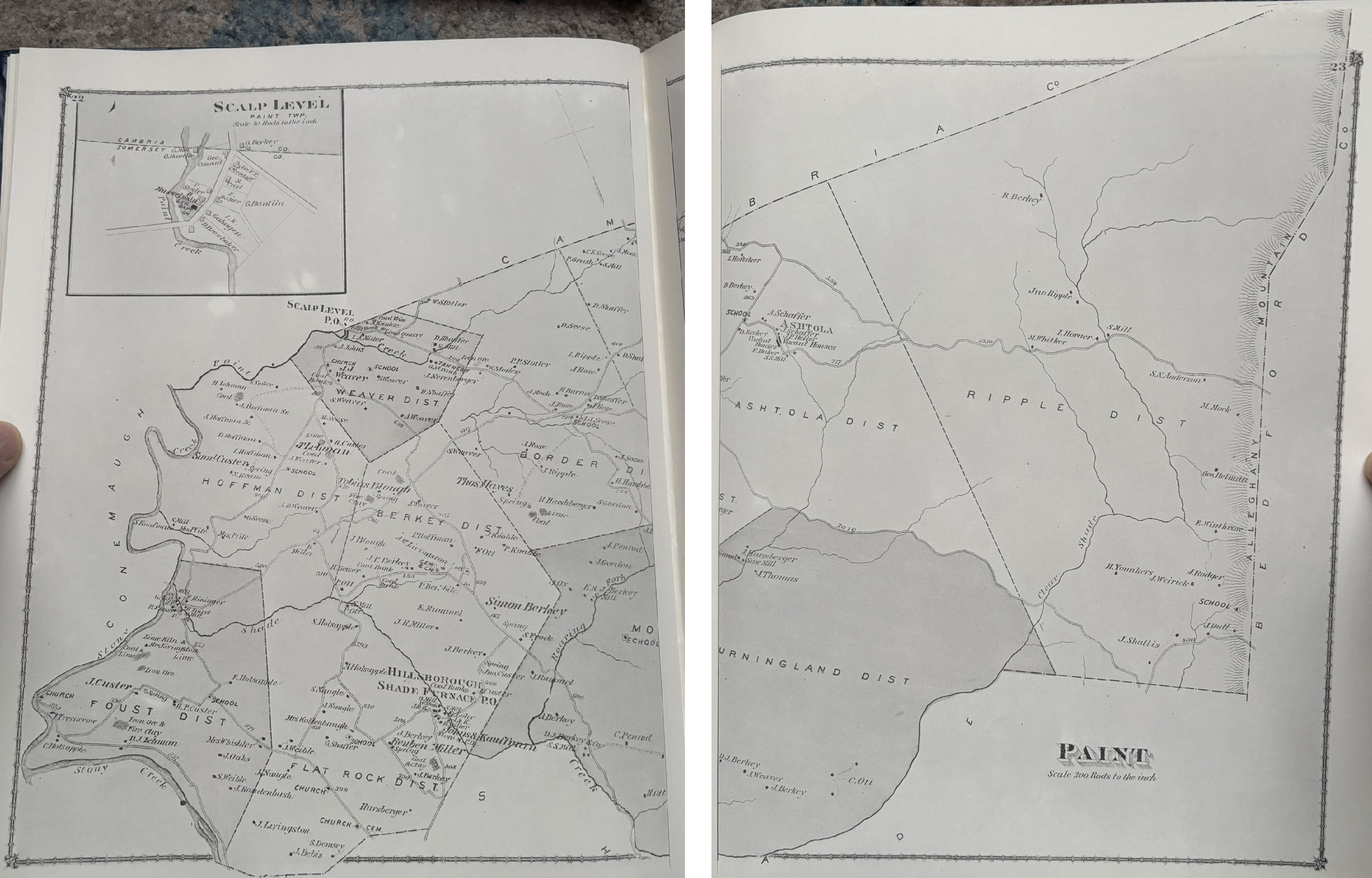
The following image is an excerpt from the Paint Township map in the 1876 "County Atlas of Somerset Pennsylvania". It illustrates a school that was located just east of the intersection of what is now Graham Avenue and Spruce Street. That intersection is located at 40.21711799186701, -78.80817558310812. Subsequent school buildings were located west of that intersection.
The following picture was provided by Donna Knupp. She reports that the large building in the foreground was the Rummel Church of the Brethren and the white building with the peaked roof in the background was the Rummel school. The school building is distinctive because the wall facing the church only has one window — an attic window.
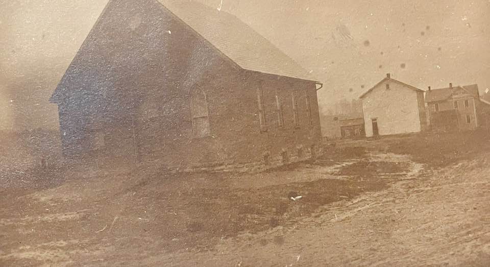
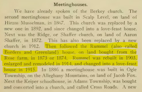
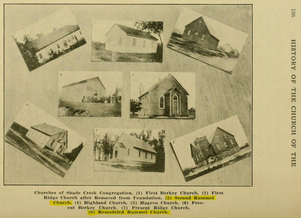
Donna reports that according to page 1348 of the "Brethren Encyclopedia" the original church building was built circa 1874, then the church was rebuilt (i.e., replaced) circa 1903, enlarged in the 1914-1915 timeframe, and lost to fire in 1971. The following two images were made from pages 185 and 186 the 1916 book "History of the Church of the Brethren of the Western District of Pennsylvania". The second image includes before and after pictures of the enlargement of the Rummel Church that occurred in the 1914 timeframe. Based on those two photos (one of which is a duplicate of Donna's photo), it is clear that Donna's church and school photo, above, was taken before the 1914 remodel.
The following 1909 Rummel School picture was provided by Donna Knupp, who reports that the school went to eighth grade in that timeframe. As with the front wall of the school building in the first photo above, the visible wall of this school building has no first-floor windows. Donna thinks that the eighth person from the right, between two boys in the top row, is her 14-year-old grandmother Cletus (Knavel) Weaver. Cletus Knavel was born in 1895, married Abram Weaver, and is buried in the Berkley Cemetery of Windber, Pennsylvania.
The following photos of the front and back of a Rummel School record card was provided by Aimee Benitez.


I have tentatively identified some of the individuals who are listed on the school record card, based on burials in the Berkley Cemetery of Windber, Pennsylvania:
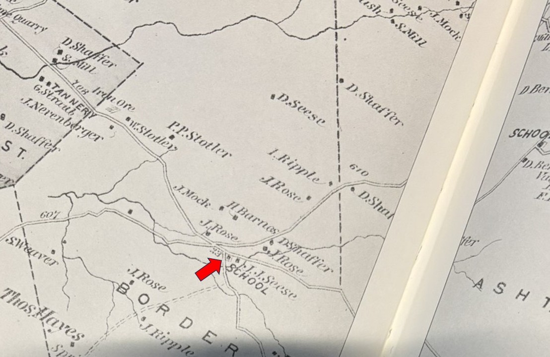
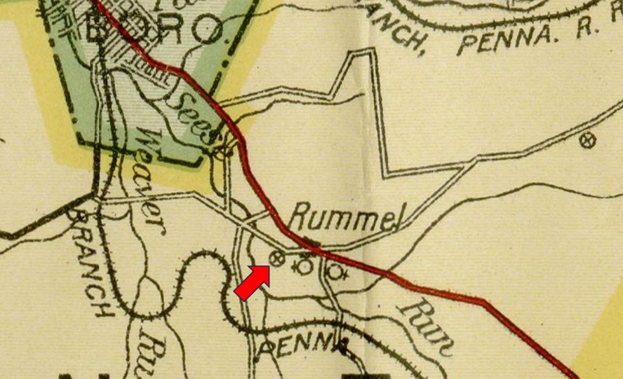
The following excerpt is from the May 1, 1915 "Map of the Public Roads in Somerset County, Pennsylvania". It illustrates two churches and a school at Rummel. The school is identified by a red arrow. The western-most church is the Rummel Church of the Brethren. Based on the 1876 map that is included above, I wonder if the eastern-most church utilized the circa 1876 school building, or was built at or near the site of that school building.
The following image is a May 25, 1939 photo of Rummel. The square structure with the pyramidal roof (circled in red) is a large replacement school building that also appears in a September 4, 1967 aerial photo. I have seen a vintage photo of this replacement school, and it had five windows on the entrance-side of the building.


