Maps from the 1876 "County Atlas of Somerset Pennsylvania"
Hit your refresh button to see the latest updates!

Introduction
This web page provides links to cell phone photos of many of the historic maps from the "County Atlas of Somerset Pennsylvania" that was published by F. W. Beers in 1876. To me, these photos are easier to use than the actual book.
L. Dietle


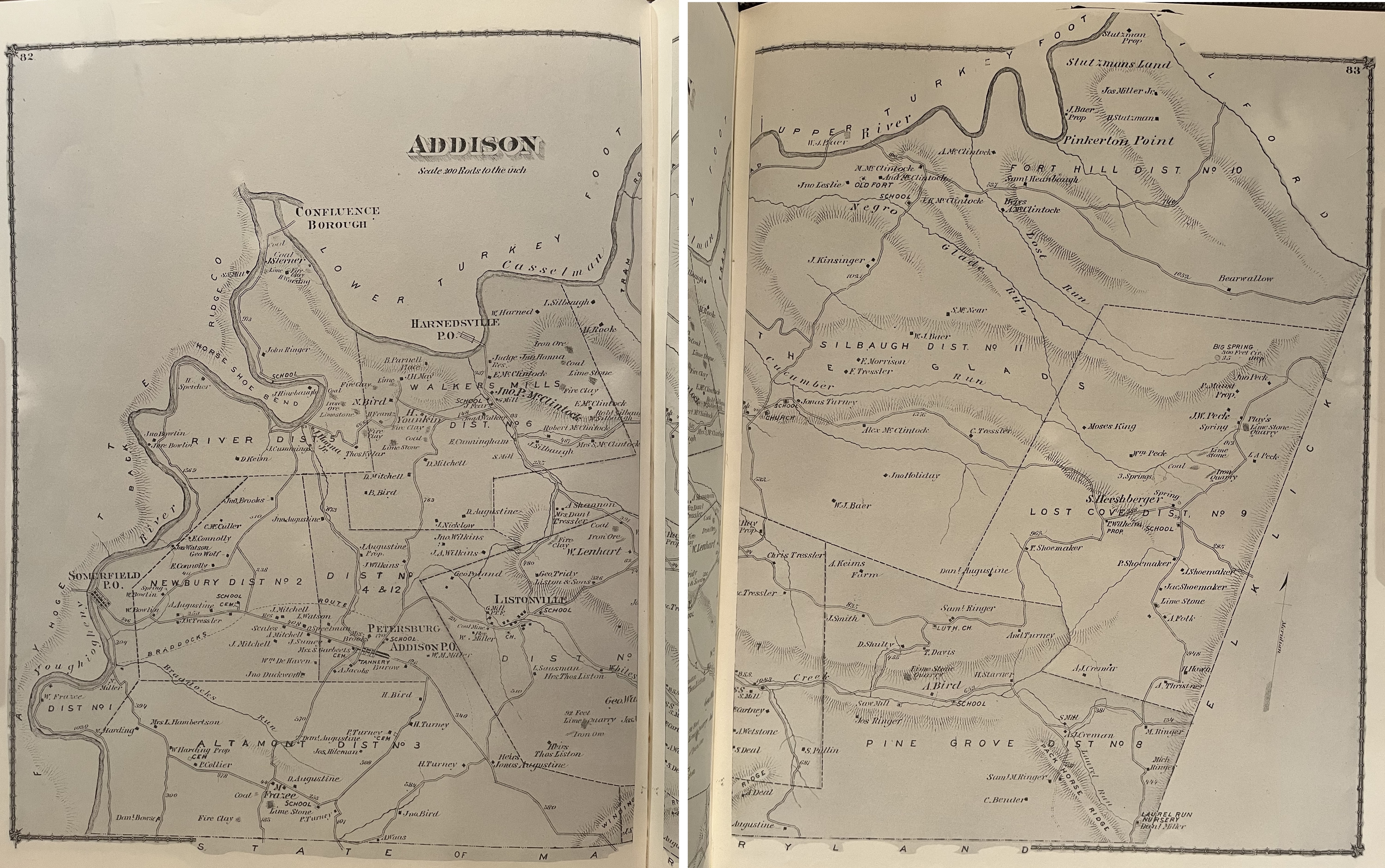
Addison Township map (7,077 KB jpg)
Alleghany Township map (736 KB jpeg)
Berlin town plat (9,081 KB jpg)
Brothersvalley Township map (6,957 KB jpg)
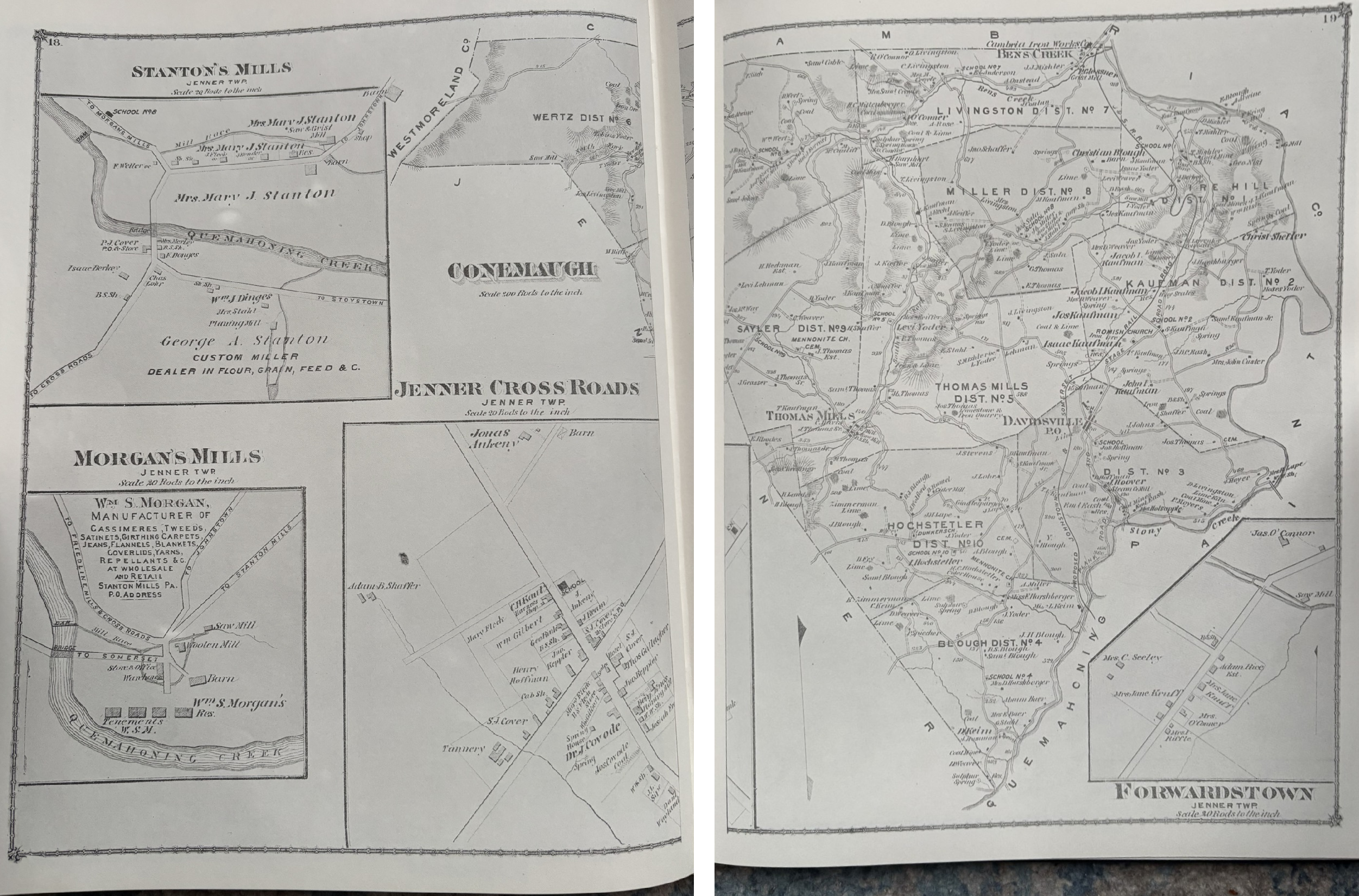
Conemaugh Township map, with Stanton's Mills, Morgan's Mills, and Jenner Crossroads town plats (4,844 KB png)
Elk Lick Township map
Greenville Township map
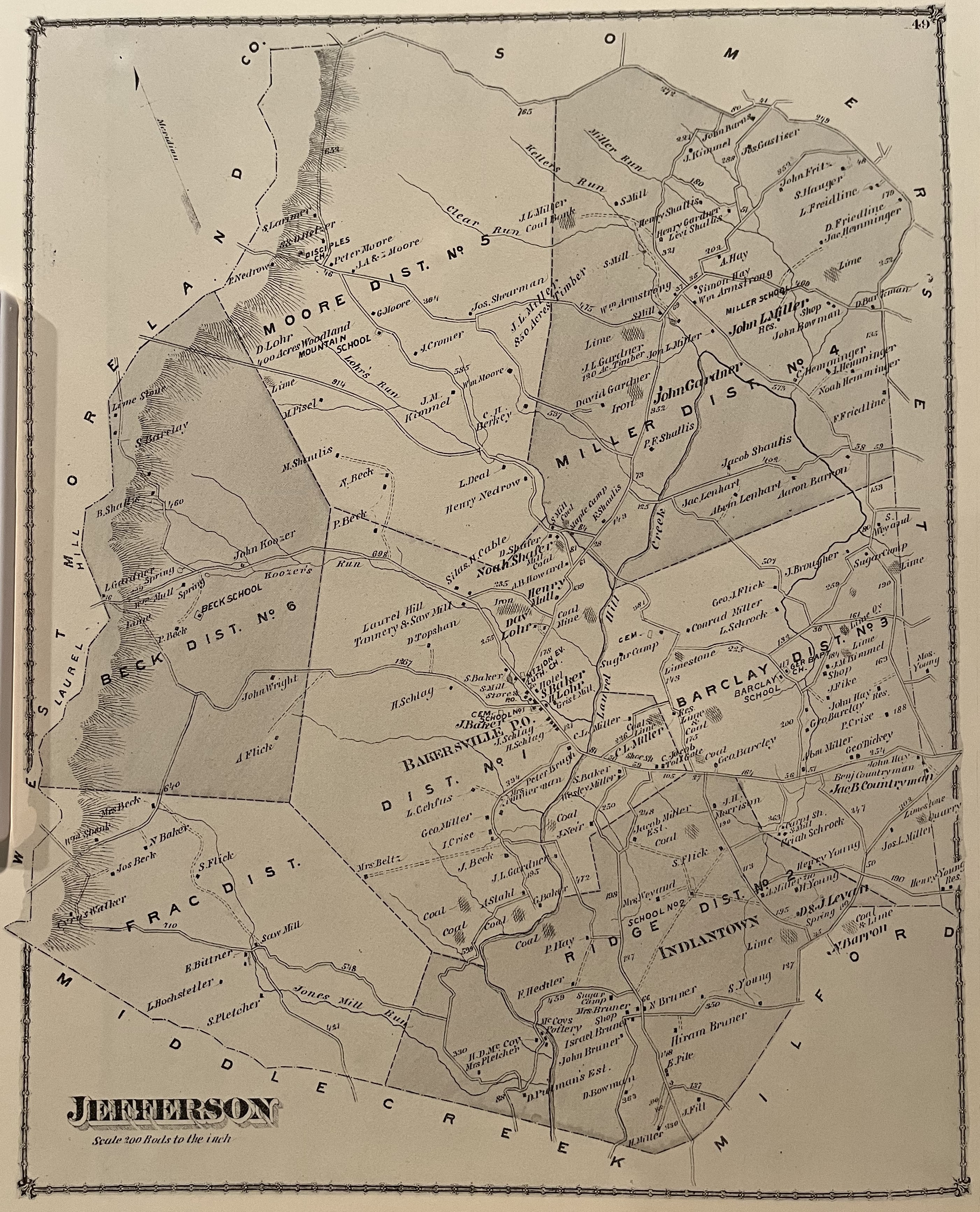
Jefferson Township map (3,356 KB jpg)
Jenner Township map, with Jennertown and Davidsville town plats (1,308 KB jpeg)
Larimer Township map
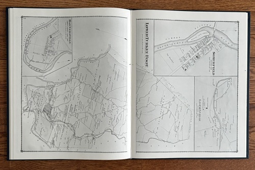
Lower Turkeyfoot Township map (6,250 KB jpg)
Middlecreek Township map (3,541 KB jpg)
Milford Township map (includes what is now Black Township)
New Baltimore town plat (2,963 KB jpg)
New Centerville & Mineral Point town plats (3,461 KB jpg)
New Lexington and Shanksville town plats (8,373 KB jpg)
Northampton Township map
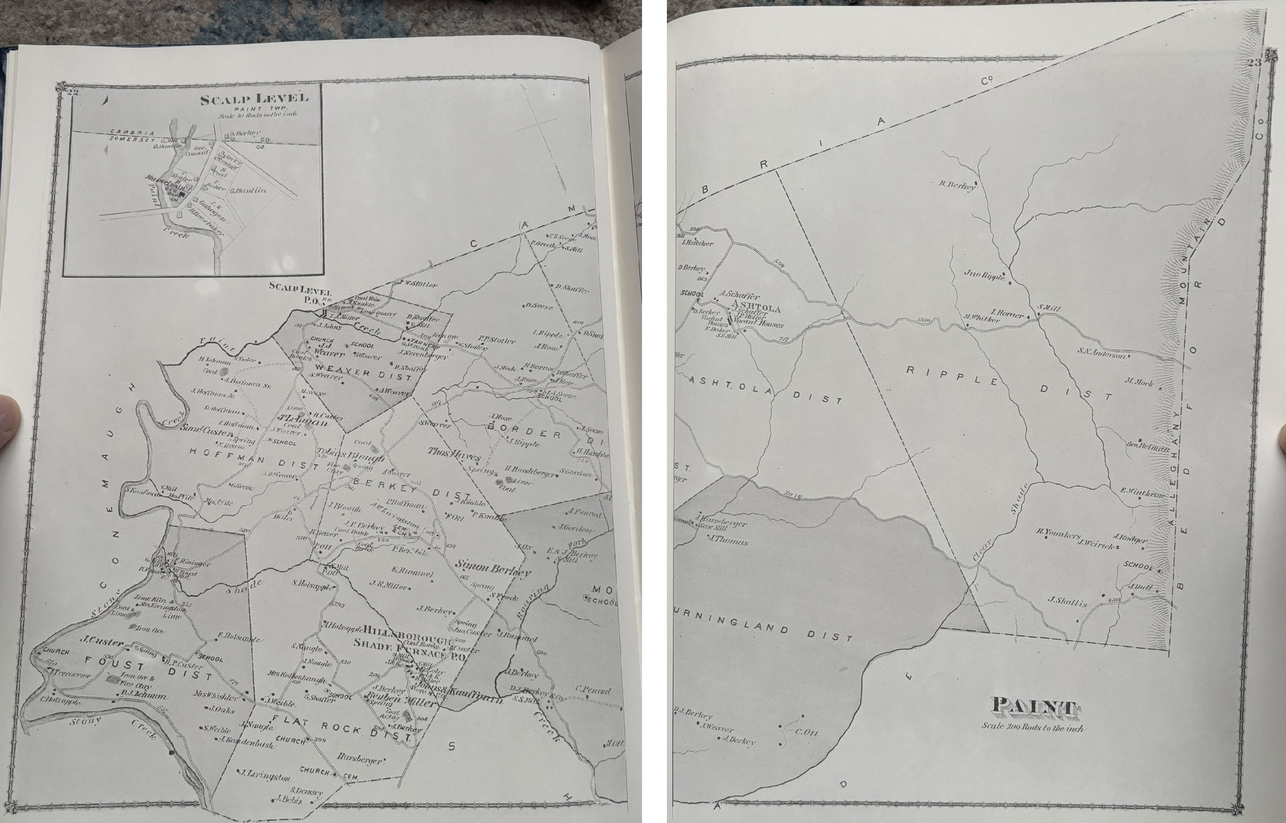
Paint Township map, with Scalp Level town plat (4,710 KB png)
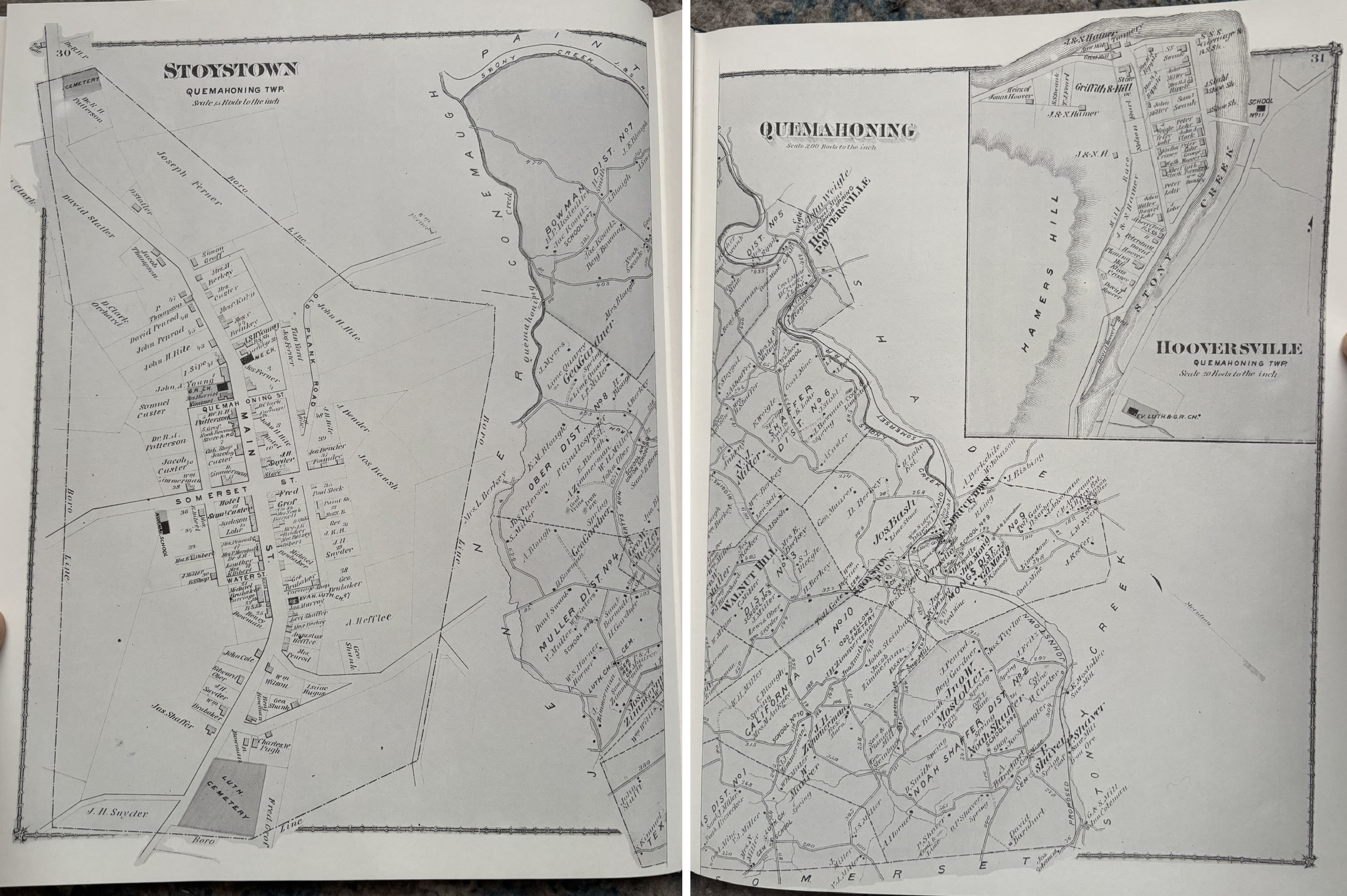
Quemahoning Township map, with Stoystown and Hooversville town plats (6,568 KB png)
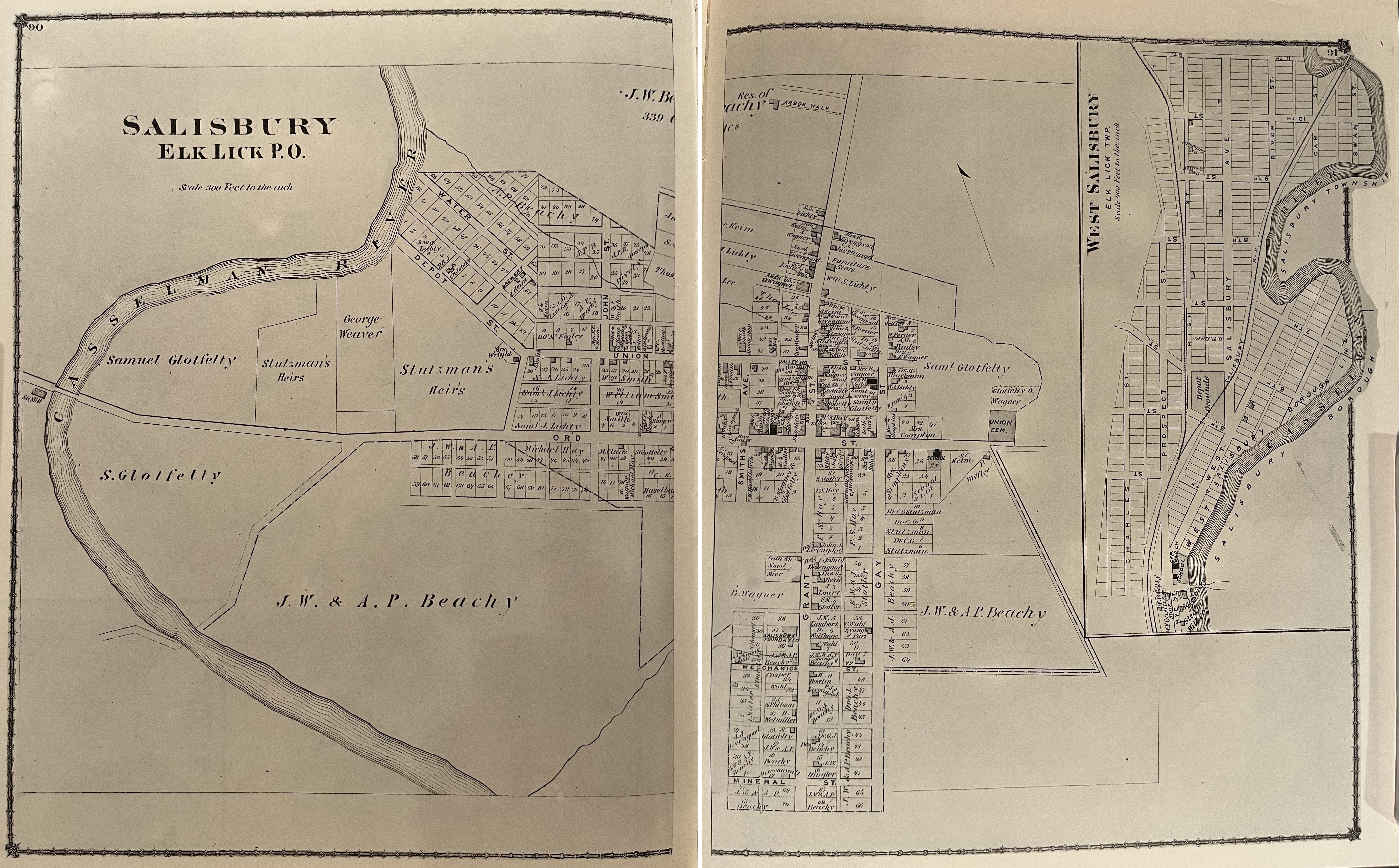
Salisbury town plat (6,774 KB jpg)
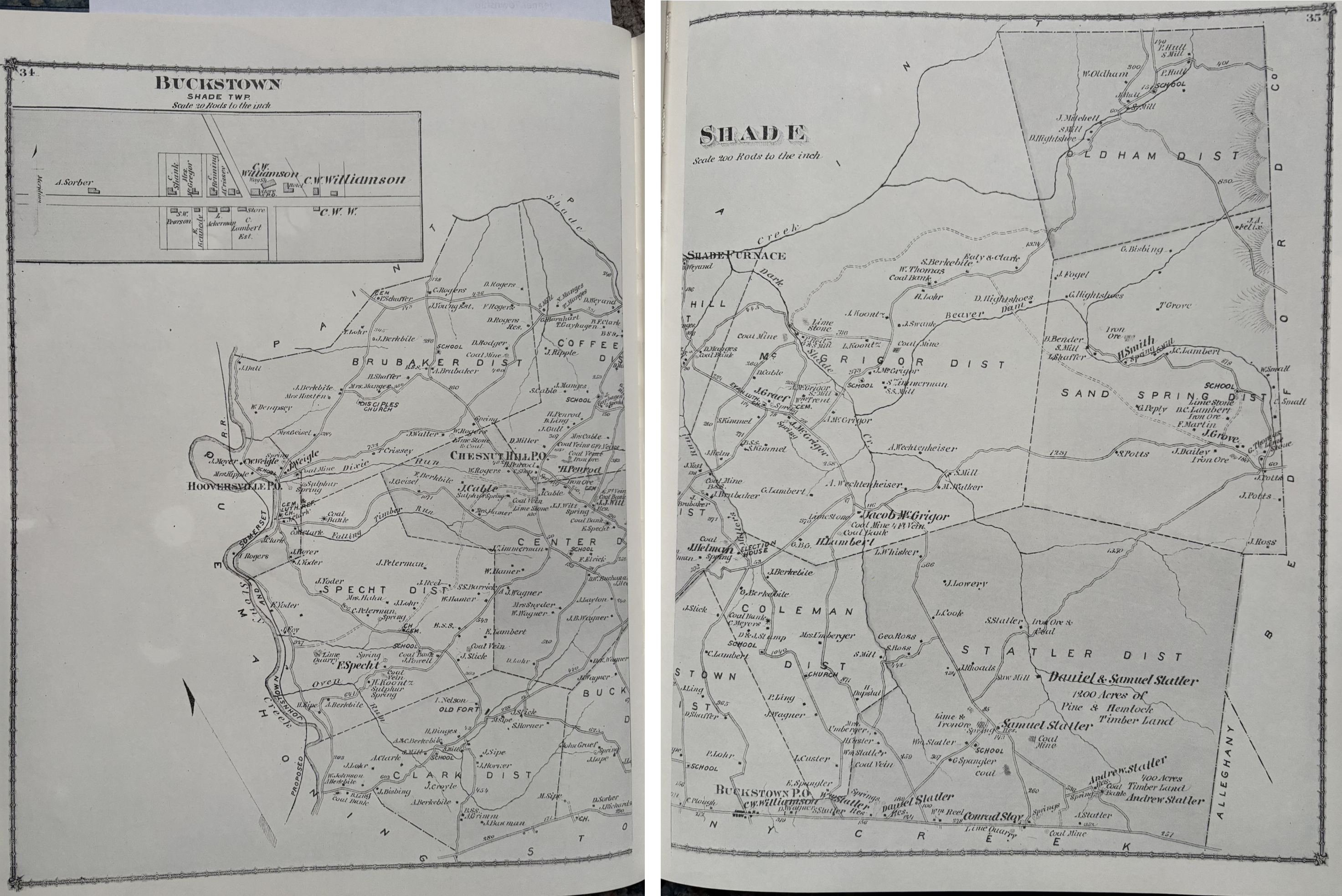
Shade Township map, Buckstown town plat (6,576 KB jpg)
Somerset town plat (5,813 KB jpg)
Somerset Township map (7,664 KB jpg)
Southampton Township map
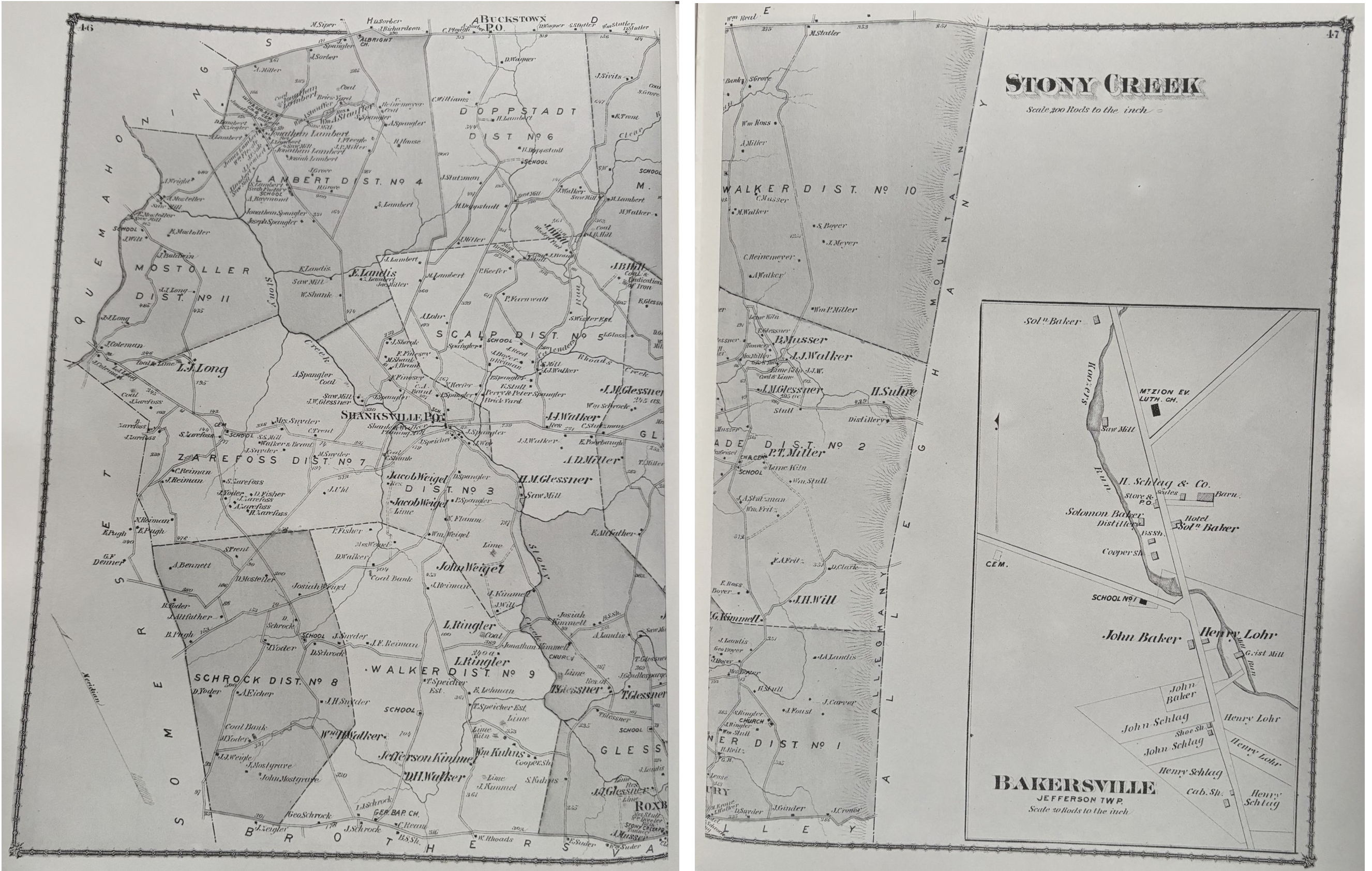
Stonycreek Township map
Summit Township map
Upper Turkeyfoot Township map
Wellersburg town plat
Go to the home page
