A 1909 class picture from the Pocahontas School
The following newspaper clippings about the Pocahontas School were found taped together in the surviving papers of my grandfather, Irvin Henry Dietle, who taught at the school during the 1918-19 term. His wife (my grandmother) Alma Catherine Miller is one of the children in the picture (first row, on the left). The village of Pocahontas is in Greenville Township, Somerset County, Pennsylvania, and Alma Catherine Miller grew up east-southeast of and near the village.

Attempting to identify the site of the Pocahontas one room school
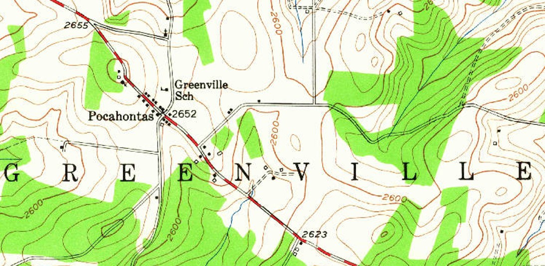
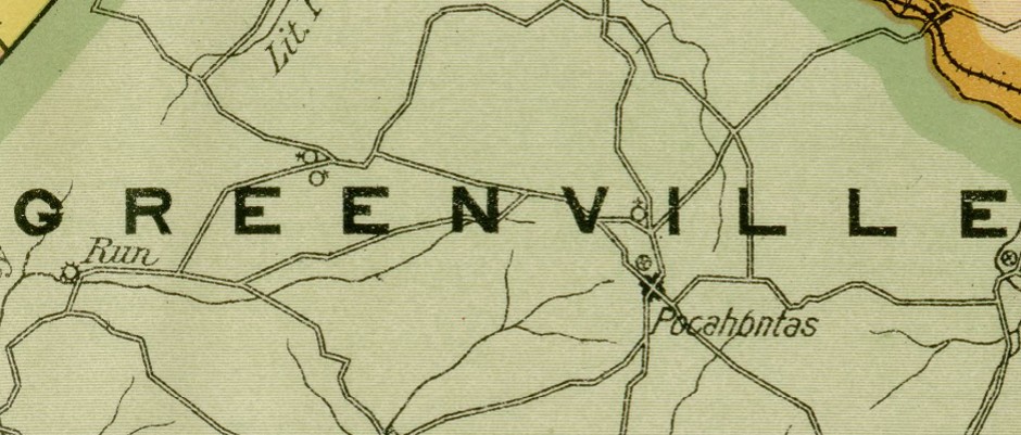
A distant cousin who was born in 1937 indicates that the old brick school was located where the township building is now (2026) located (39.74263932831322, -78.95866331115909), and thought that the brick school building was built in 1937 and used until 1965. The following excerpt from the 1966 edition of a 1949 topograpic map identifies the old brick school building at the aforementioned location as being called the Greenville School.
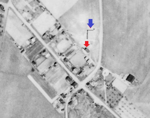
In the following May 4, 1939 aerial photo, the old brick school is identified with a blue arrow. A red arrow identifes what could possibly be the old school that is illustrated on the Pocahontas town plat in the 1876 Beers atlas, or — in view of the orientation of the building — perhaps a newer school built at about the same location as the school on the 1876 plat.
The aforementioned distant cousin indicates that the one room school in the 1909 photo was directly across the road (i.e., on the eastern side of Warrens Mill Road) from where the brick schoolhouse stood. If that is correct, it seems surprising to me that no trace of such a building appears on the preceding May 4, 1939 aerial photograph.
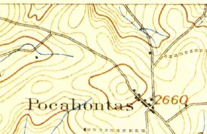
No building is illustrated at the requisite location on the east side of Warrens Mill Road on the following three topographic map excerpts. Each of the following excerpts could, however, be interpreted as possibly illustrating the school that is illustrated on the town plat in the 1876 Beers atlas. (As far as I can determine, the 1898, 1901, and 1908 topographic maps did not use a special symbol to represent schools.)
1898 map:
1901 map:
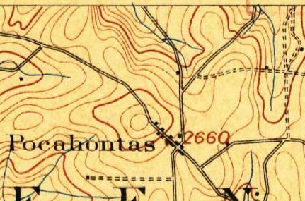
1908 map:
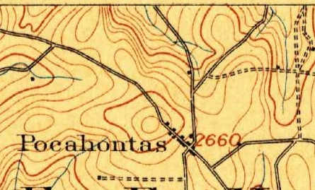
The following excerpt is from the May, 1915 "Map of the Public Roads in Somerset County, Pennsylvania". A symbol for a school is located west of Warrens Mill Road.
Based on the above information, I suspect that the school building in the 1909 photo was on the west side of Warrens Mill Road. I suspect that it may have been the school building illustrated on the 1876 town plat, or a newer building that was located at or near the same site as the school on the 1876 town plat.
L. Dietle
Go to the Somerset County, PA school index page

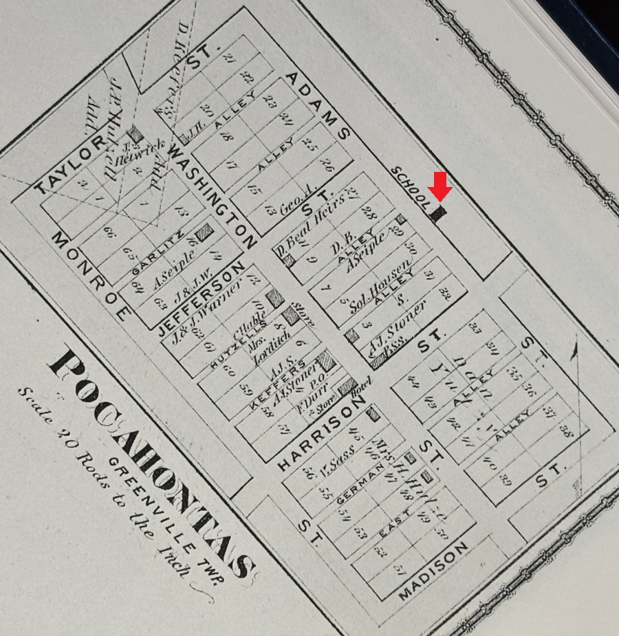
The following image of the Pocahontas town plat from the 1876 Beers Atlas of Somerset County, Pennsylvania identifies the location of a school house (red arrow). I wonder if this school house was still being used in 1909, when the class picture that is included above was taken. The Harrison Street on the 1876 map would be the Warrens Mill Road of today (2026).