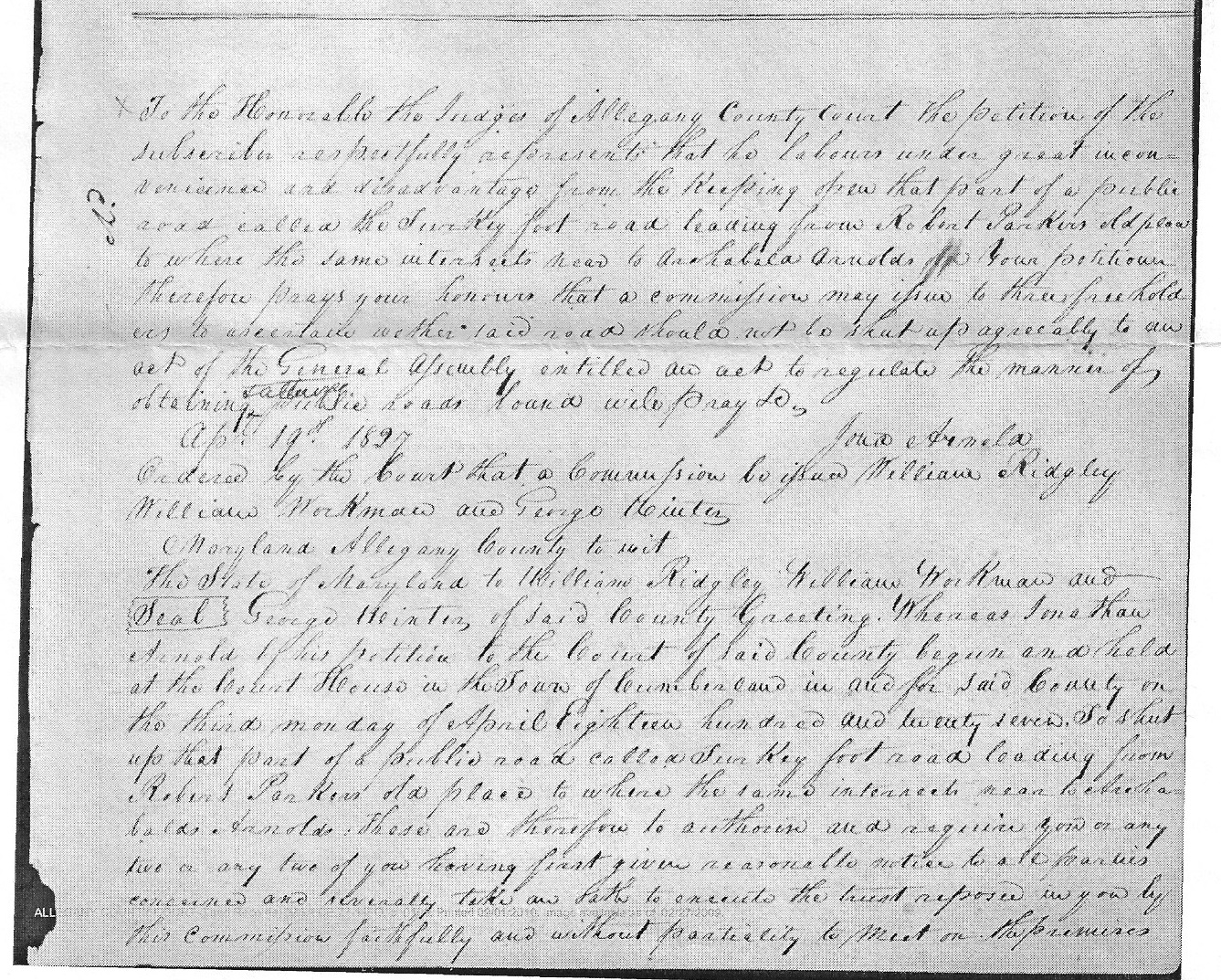
The following 1827 survey was performed as part of a partially unsuccessful attempt to close part of the Turkey Foot Road in the Arnold's Settlement portion of Allegany County, Maryland. The road closure survey concerns a portion of the present-day blacktop road that is known as Mile Lane and a now-closed portion of the Turkey Foot Road that passed through an area that is known locally as the "Mule Field".

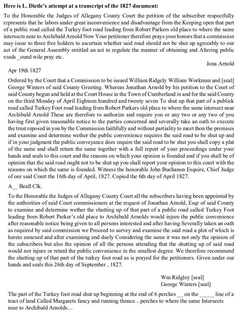
The next image captures my attempt at preparing a transcript of the 1827 road closure document.
The following image is a composite of three different surveys that shows how part of Mile Lane was determined to be a surviving section of the old Turkey Foot Road. The 1827 road closure survey is at the bottom. At the top, a modern plat map is superimposed on a 1787 plat map.

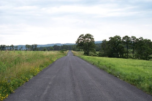
The following picture was taken looking east-northeast (from 39.703109, -78.86909) at a surviving section of the Turkey Foot Road across Level Ridge that is shown on the 1827 road closure survey. Nowadays, this part of the old Turkey Foot Road is known as Mile Lane.
The following zoomable interactive map compares the Turkey Foot Road (red dots) to Braddock's Road (blue dots). Many of the dots are links that can be clicked for additional information.
The following video (1:48) summarizes the Revolutionary War origin of the Turkey Foot Road and then provides a virtual photo and map-based tour of the road. For detailed information on the Revolutionary War origin of the Turkey Foot Road, see Volume 2 of the "Fort Cumberland" book set.
For best viewing results, watch the video in high-definition mode on YouTube.
L. Dietle

