
The 2009 photos on this page were provided by Mike McKenzie. They show a farm that is located east of Wellersburg, below the State Line road, and straddling the Mason-Dixon line. It is presently owned by Mr. K. Detrick, who has owned it since 1965, but has never lived there. When Mike interviewed Mr. Detrick, Mr. Detrick mentioned:
Mike thinks he recalls that before George Sturtz, a Kennel owned the property, and Sturtz traded a house in Wellersburg for the farm, however Mike indicates thats he needs to verify the story.

A small portion of this farm, located below the Mason Dixon Line, was lot 3356 of the Veatch Survey, and belonged to Michael Korn, Sr.
Click here to see a 1939 aerial photo of the farm with an annotation that identifies lot 3356.
To see an enlarged portion of the 1939 aerial photo that shows the farm buildings, which are located north of the Mason Dixon line, click here.
+++++++++++++++++++++++++++++++++++++++++++++++++++++++++++++++++++++++++++++++++

Photo 1: The above photo of the house and farm was taken looking generally east, and shows Will's Mountain in the background. The left hand side of the photo also shows the current pipeline right-of-way along the Mason Dixon line.
+++++++++++++++++++++++++++++++++++++++++++++++++++++++++++++++++++++++++++++++++
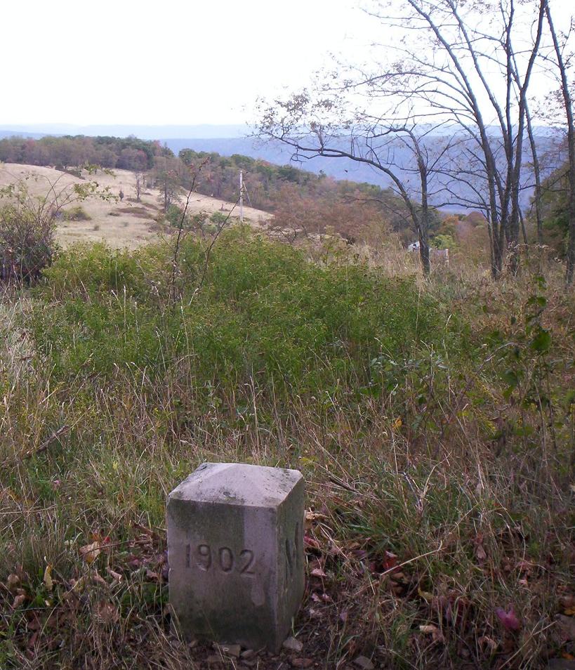
Photo 2: The above photo was taken looking into Pennyslvania from the Mason-Dixon line; note the marker in the foreground and the remains of the house in the background.
+++++++++++++++++++++++++++++++++++++++++++++++++++++++++++++++++++++++++++++++++

Photo 3: The above photo shows the house in the background, and the barn foundation on the left, in the foreground. Click here for an enlargement of the house portion of this photo.
+++++++++++++++++++++++++++++++++++++++++++++++++++++++++++++++++++++++++++++++++

Photo 4: The stone house foundation is made with cut stone and used mortar, and does not match the quality of the barn foundation.
+++++++++++++++++++++++++++++++++++++++++++++++++++++++++++++++++++++++++++++++++

Photo 5: The above photo shows the collapsed remains of the spring house that was located near, and just below, the farm house. As can be seen in the photo, the springhouse foundation was made with cut stone.
+++++++++++++++++++++++++++++++++++++++++++++++++++++++++++++++++++++++++++++++++
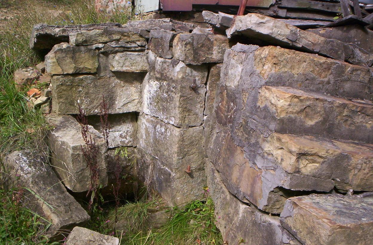
Photo 6: The above photo shows a spring that was built into the wall of the house. Unlike the rest of the house foundation, the stonework around the spring appears to be built without mortar. The iron hinges to the spring gate are still intact. Mike reports that he saw an iron pipe that apparently went from this spring to the springhouse. The spring house has a concrete trough. Mike reports that the stone steps at the spring appear to be more recent than the core mortar-free stonework.
+++++++++++++++++++++++++++++++++++++++++++++++++++++++++++++++++++++++++++++++++
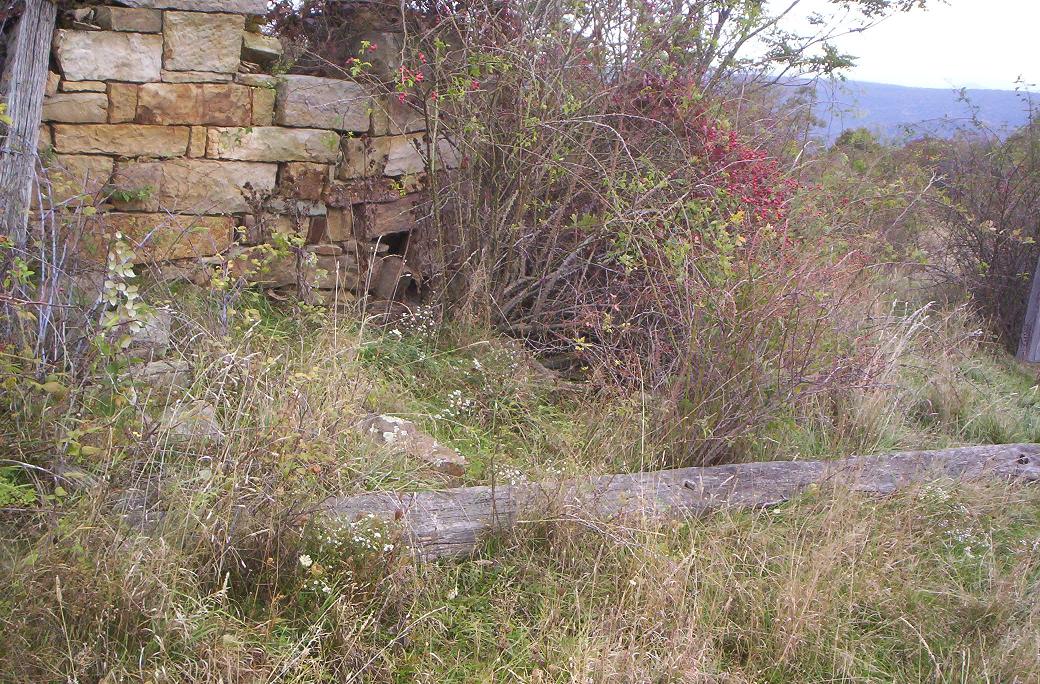
Photo 7: The above photo shows the remains of the barn, which collapsed long ago. The beam is hewn (not sawed), and Mike estimates that it is at least 30 foot long. The cut stones in the foundation represent exceptionally good stonework. The foundation has no mortar.
+++++++++++++++++++++++++++++++++++++++++++++++++++++++++++++++++++++++++++++++++
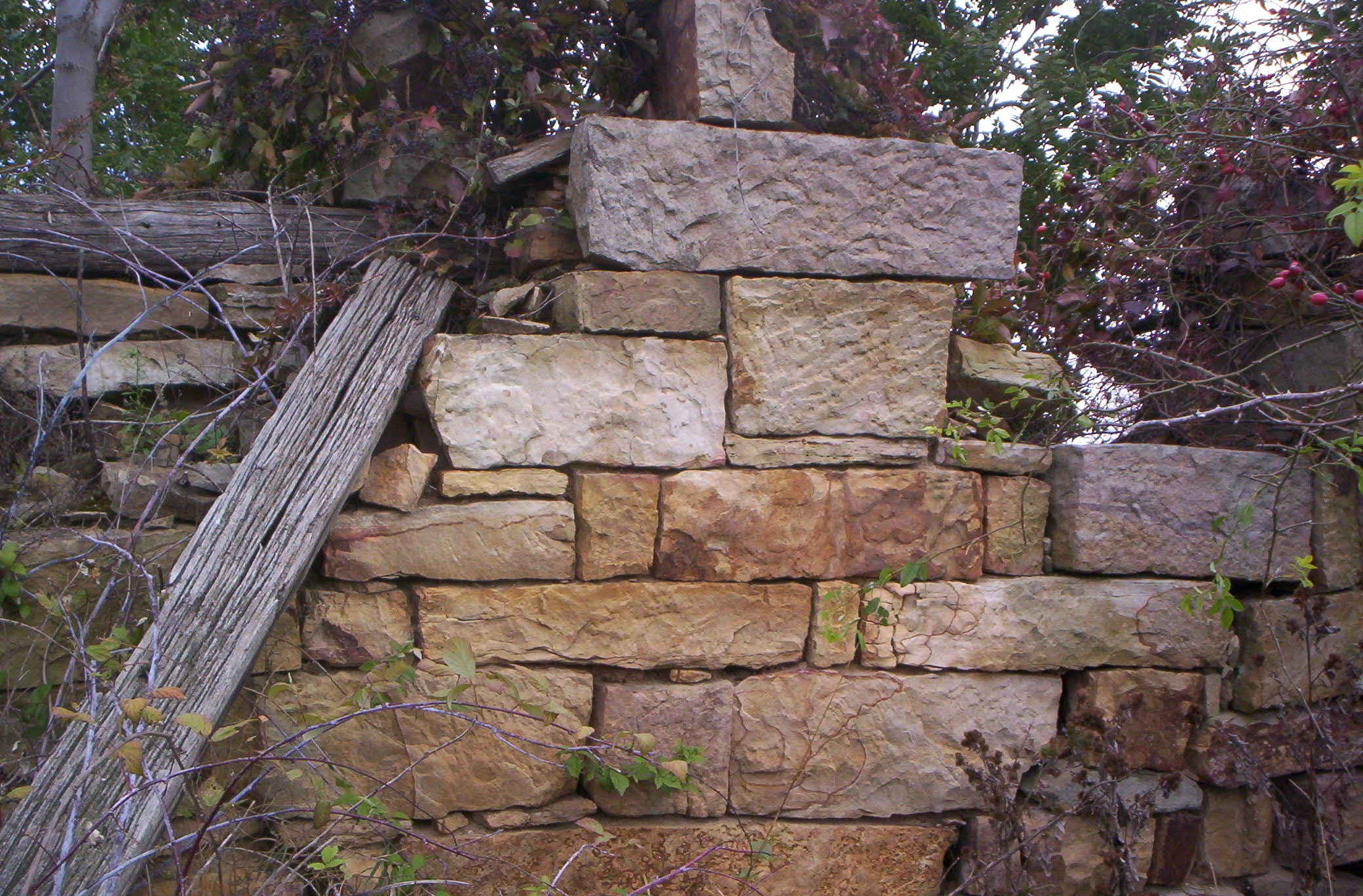
Photo 8: The above photo shows more of the stonework from the barn foundation.
+++++++++++++++++++++++++++++++++++++++++++++++++++++++++++++++++++++++++++++++++

Photo 9: The stone pile in the above photo is located between the house and old barn foundation. The stones are in a square pattern, but there is no mortar. The foundation of at least one other local building, the Fink Church, was clearly made using uncut stone without mortar, but we simply don't know if these particular stones are the collapsed remains of a foundation.
+++++++++++++++++++++++++++++++++++++++++++++++++++++++++++++++++++++++++++++++++

Photo 10: The above photo was taken looking southwest across the Mason Dixon line, near Detrick Lane. The fields in the background are the Michael Corn lot 3356. The Mason-Dixon Line marker appears to have been a 1902 replacement. The "P" on the marker faces the state of Pennsylvania.
+++++++++++++++++++++++++++++++++++++++++++++++++++++++++++++++++++++++++++++++++
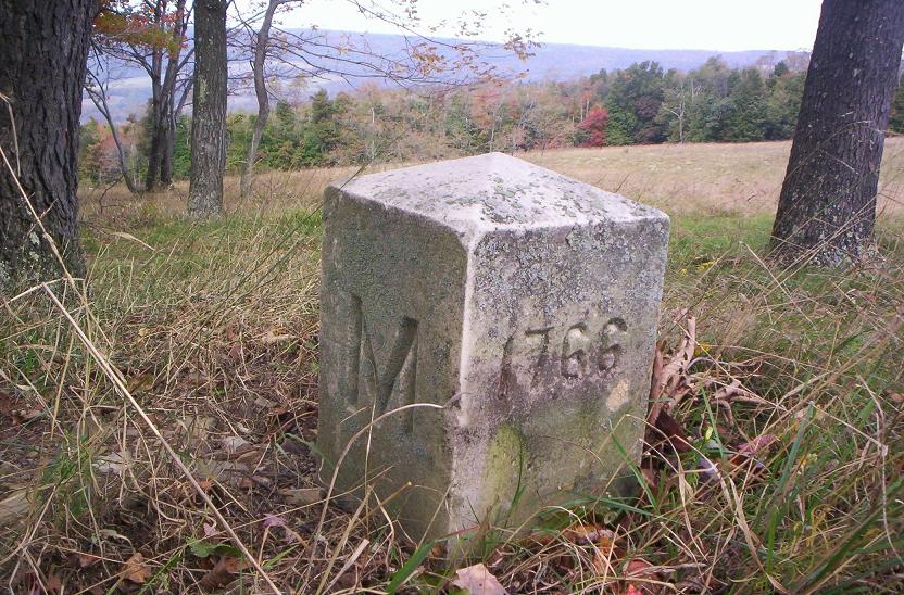
Photo 11: The photo was taken near Detrick Lane, looking northwest in the direction of Wellersburg, across the Mason Dixon line and into the state of Pennsylvania. The Mason-Dixon Line marker appears to have been a 1902 replacement. The "M" on the marker faces the state of Maryland. This is marker number 176; there are markers every mile and each one is numbered. Click here to read more about the Mason-Dixon line.
+++++++++++++++++++++++++++++++++++++++++++++++++++++++++++++++++++++++++++++++++

Photo 12: The above photo shows an internally-threaded pipe collar/union that is about 6 inches in diameter, and appeared to be broken off. Mike saw what appeared to be an old right of way along the edge of a field. He found this down over the side of the old right of way, using a metal detector. As can be seen in the photo, the collar had been buried in coal shale. It may be that the shale was dug up when the pipe was laid, because the coal is shallow in this area.
This pipeline matches eyewitness reports of the type of pipe that was removed in the early 1980's when the latest pipeline was installed. Mike McKenzie was told that the old pipeline was installed in 1902, and this may be the reason that the Mason-Dixon line marker matches this date. Now we know that the old pipe line right of way was right along the state line. We surmise that this pipeline was likely being served by one or both of the pumping stations that were located in Wellersburg and Ellerslie. Click Here to see our web page on the Wellersburg pumping station.
+++++++++++++++++++++++++++++++++++++++++++++++++++++++++++++++++++++++++++++++++

Photo 13: The above photo shows an old tractor that is located on the farm.
+++++++++++++++++++++++++++++++++++++++++++++++++++++++++++++++++++++++++++++++++
Return to the Korns family genealogy home page
