Return to PART TWO of the Turkey Foot Road tour
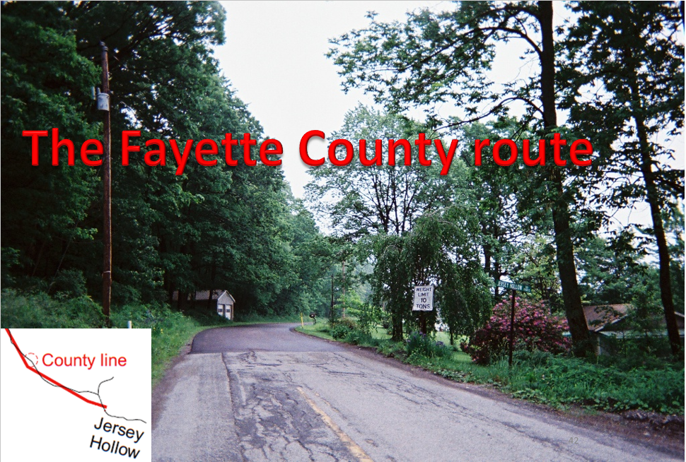
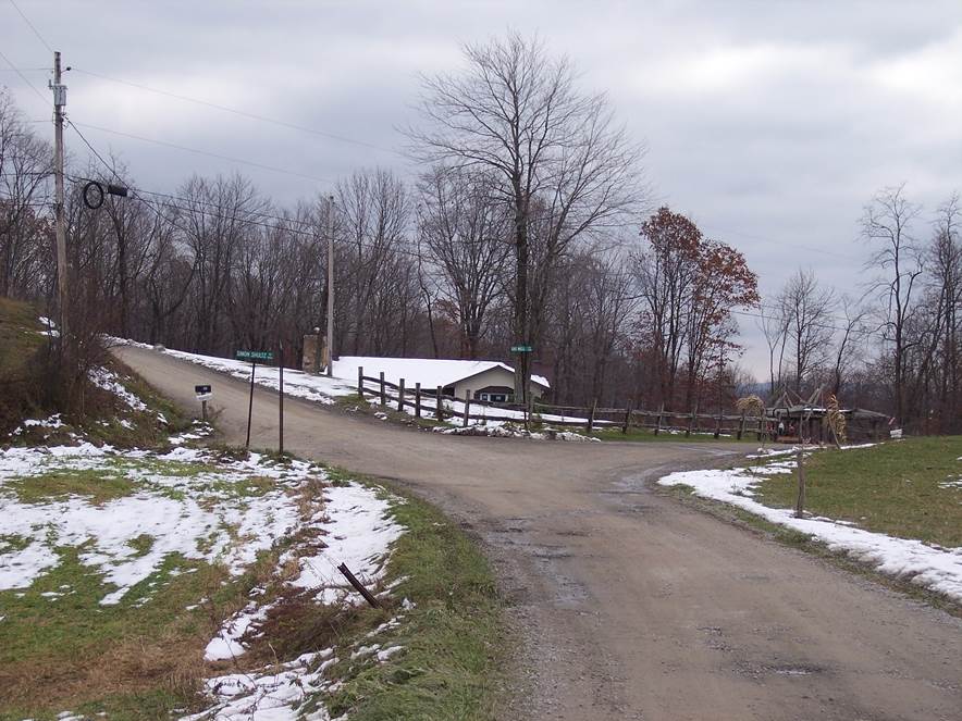
The Fayette County line
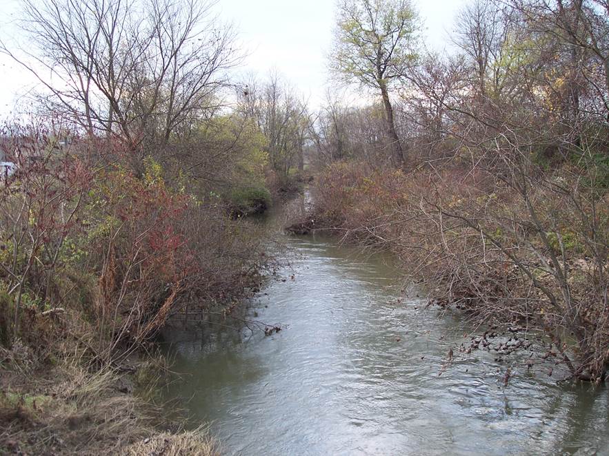
This picture was taken from Fayette County, looking back into Somerset County, on Laurel Hill. The seam in the blacktop is the county line [ 39.900733, -79.399017]. Here, the modern road name changes from Jersey Hollow Road to Maple Summit Road.
The red line on the inset map is the route shown on early surveys. The modern route is black. The roads marked on early surveys were only intended to locate the properties. They weren't intended to show every little twist and turn of the road. In other words, the roads on early surveys are schematic, straight line representations. Although not all of the route is shown on the old surveys, between 39.889126, -79.374783 and 39.909868, -79.407034, Jersey Hollow Road, Maple Summit Road, and Schroyer Road are the present alignment of the route shown on 1794 surveys.

A summary of the Fayette County route is published online by the Bullskin Township Historical Society.
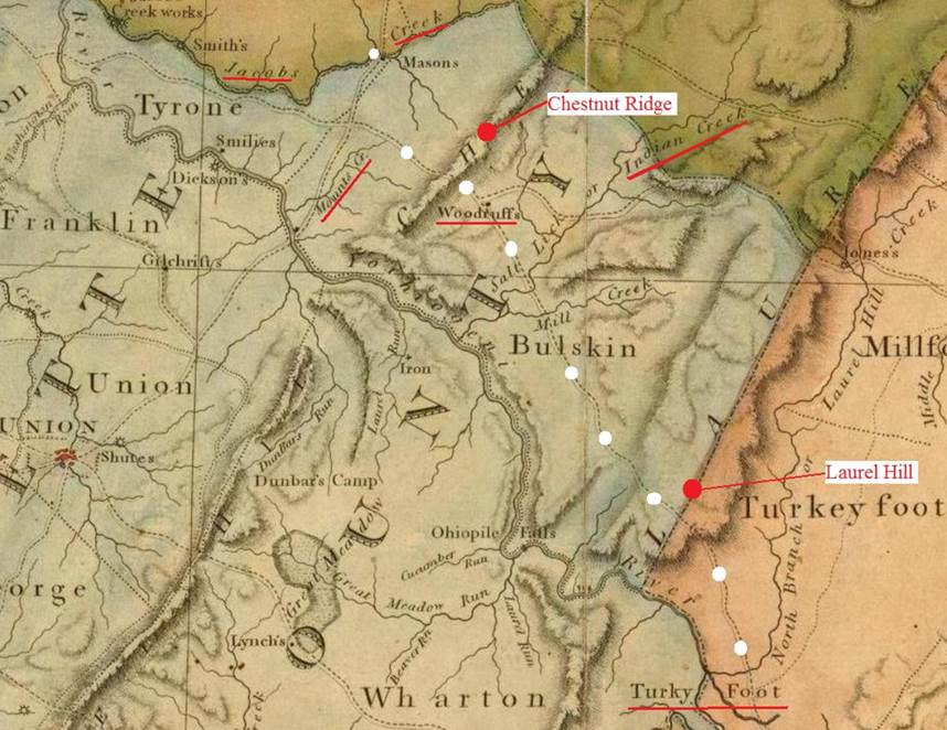
The 1792 route across Fayette County (Reading Howell map)
This image shows Fayette County on a 1792 map. In Fayette County, the only landmark along the road is the Woodruff farm. It took a great deal of effort to locate that farm. After I did, I discovered that one of my relatives was a subsequent owner.
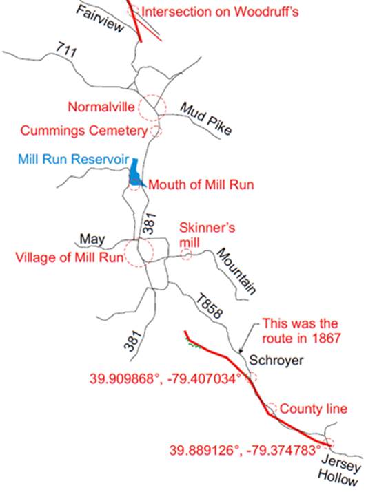
The southern part of the Fayette County route
This is an overview of the route across southern Fayette County. The thick red lines are from early surveys. Green dots represent sections identified with aerial photos. Some of the area was surveyed too early to show the Turkey Foot Road, and all we have in that area is tantalizing clues.
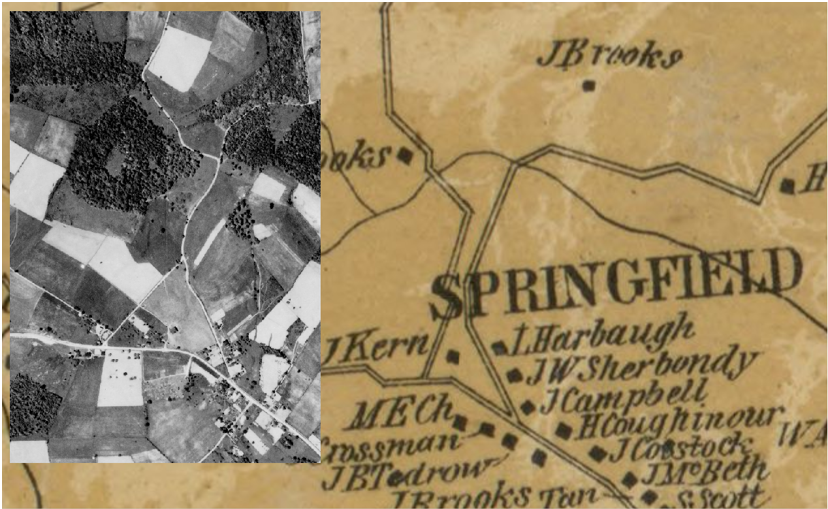
In the 1860s, Route T858 was known as the old Turkey Foot Road. In the 1700s, the Turkey Foot Road was located farther west, taking a direct route toward the Indian Creek Baptist Church. That church is south of the village of Mill Run, on Route 381. The road passed through the village, and crossed Indian Creek at Mill Run Reservoir. After that, it passed through Normalville on the way to Woodruff's.
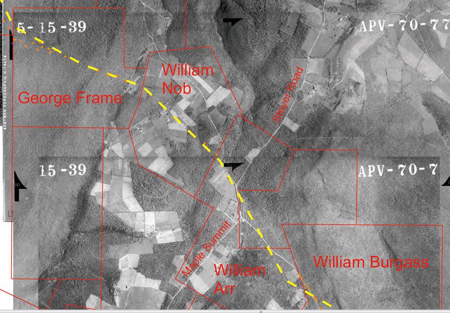
The 1794 route departs from the modern route
This is a warrant survey map superimposed on a 1939 image. The image is tiled from several different photographs. The map isn't a perfect match to the image. This is because the image isn't orthorectified. In other words, it's distorted, because some of the terrain was farther from the camera. The distortion increases near the edges of photographs. Keep this distortion in mind when looking at my aerial photographs.
The yellow dashed lines are the roads shown on the surveys. The orange dots in the upper left hand corner highlight a trail that is visible on the image. This trail appears to be the old Turkey Foot Road.
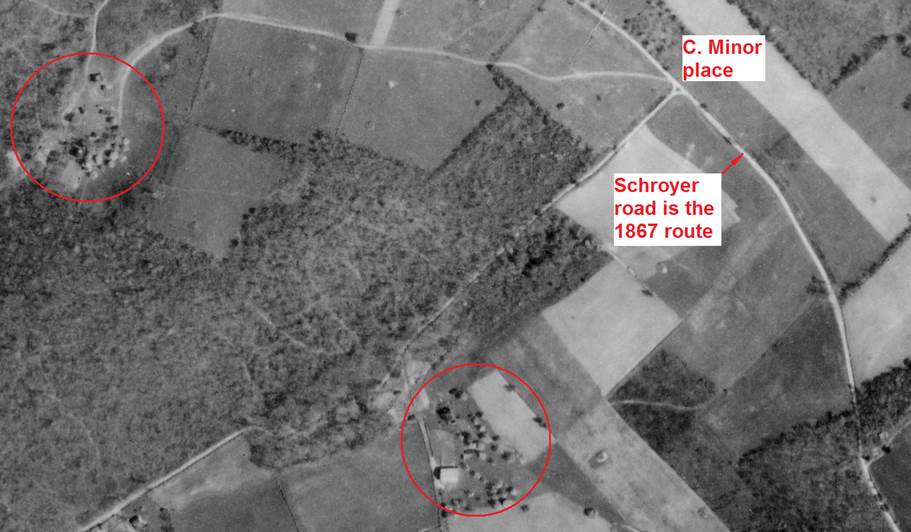
At 39.909868, -79.407034 the 1794 route departs the modern road at the site of the old Maple Summit stagecoach site, at a place now known as Nicolay, and heads generally northwest in the general direction of the Indian Creek Baptist Church, passing through several now abandoned farmsteads along the way. As noted above, the 1867 route is located farther to the east, and is still known as the Turkeyfoot Road today.
Farms along the 1794 route
This is enlarged from the previous image. The two circles show old farms that were located along the 1794 route. This explains why the farms are located so far west of Schroyer Road. One of the old farmsteads was located at approximately 39.917147, -79.418299. As with a number of old farmsteads, the reason these two are located so far from the present-day road is because they were originally located on a now-abandoned section of the Turkey Foot Road.
This image also identifies the location of the Charles Minor place. An 1867 newspaper indicates that he bought a farm on the old Turkey Foot Road. This proves that by 1867, Schroyer Road was the existing version of the Turkey Foot Road.
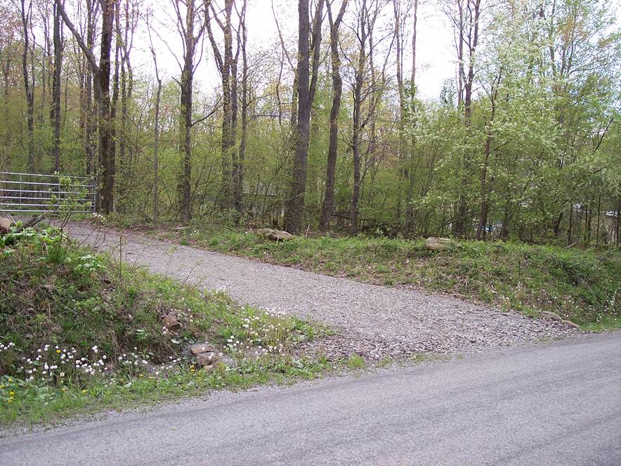
Site of the Maple Summit stagecoach stop
This is where the 1794 route split from the 1867 route at 39.909868, -79.407034. This is where the Maple Summit stagecoach stop was located; it was named for a large maple tree. Before this modern lane was made, there was a groove in the embankment from the 1794 route.
In the next several captioned images, we are going to head down the 1867 route.
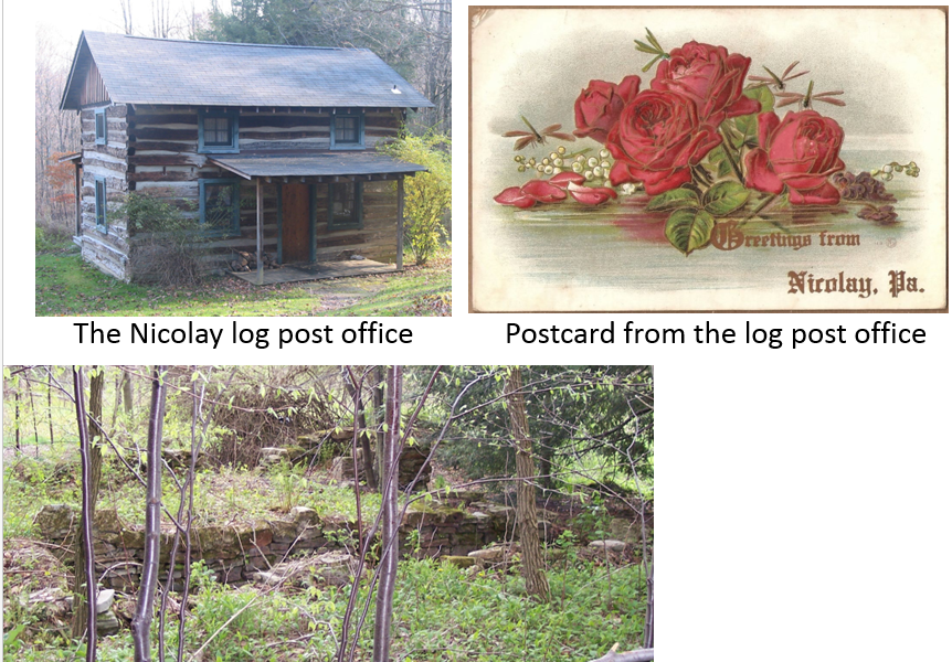
Nicolay log post office
The old Nicolay log post office was located on the 1867 route. It was located a little north of the place where the 1794 and 1867 routes split, on the west side of the road. It was established in the mid-1880s.
This stone foundation is shown at the lower left. The building was dismantled, and rebuilt at Fallingwater.
The postcard was mailed from Nicolay in the early 1900s.
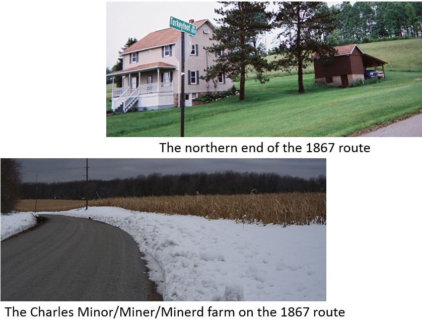
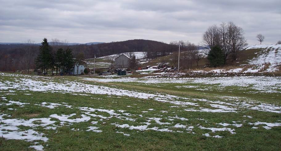
The newer route that was already old in 1867
The bottom picture is the remarkably level Miner farm, which is located on the 1867 route. The Miner name is spelled various ways. According to family tradition, the "d" was dropped when the army wrote the name on enlistment papers. The Minerd home would have been located roughly at 39.918574, -79.411776.
Not long ago, five bear were taken in one season on this farm. After that, crop damage hasn't been so bad.
The upper picture is the northern end of the present day Turkey Foot Road [39.941603, -79.441928]. In 1858, the route was on the far side of the house,
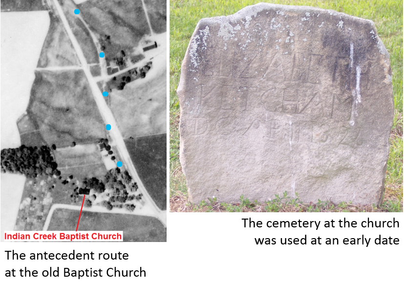
Indian Creek Baptist Church
The first building of the Indian Creek Baptist Church was built along the Turkey Foot Road on land donated by Abraham Skinner. The current building is located at 39.940256, -79.44981.
The image on the left was taken in 1939. The blue dots show an older road at the Indian Creek Baptist Church. Whether or not it's the original route of the Turkey Foot Road is unknown. Nevertheless, it is one embodiment of the Turkey Foot Road. Route 381 is the current embodiment.
The church is named for the Indian Creek settlement. A Fayette County history book mistakenly states that the church was organized in 1843. The congregation was represented at a meeting in Bridgeport, West Virginia in September, 1800. This proves that the 1843 date in the history book is wrong.
The Turkey Foot Road passed through the village of Mill Run
North of the Indian Creek Baptist Church, the village of Mill Run was built along the Turkey Foot Road where the old Turkey Foot road crossed Mill Run [39.95179, -79.454517], according to the 1882 book "History of Fayette County, Pennsylvania". This is Route 381, looking north-northwest into the village of Mill Run. A short section of the old alignment of the road is visible through the guard rail. The bridge across Mill Run can be seen in the distance.
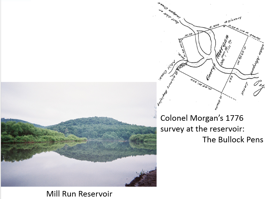
The Bullock Pens
North of the village of Mill Run, the old road crossed Indian Creek at Mill Creek Reservoir [39.973478, -79.452846]. This is the property purrchased by George Morgan in 1776, and the site of his Revolutionary War bullock pens. The property was used to pasture cattle that were being driven to Fort Pitt. His 1776 survey is shown on the right. In 1779, he offered to sell the property for eight bushels of Indian corn.
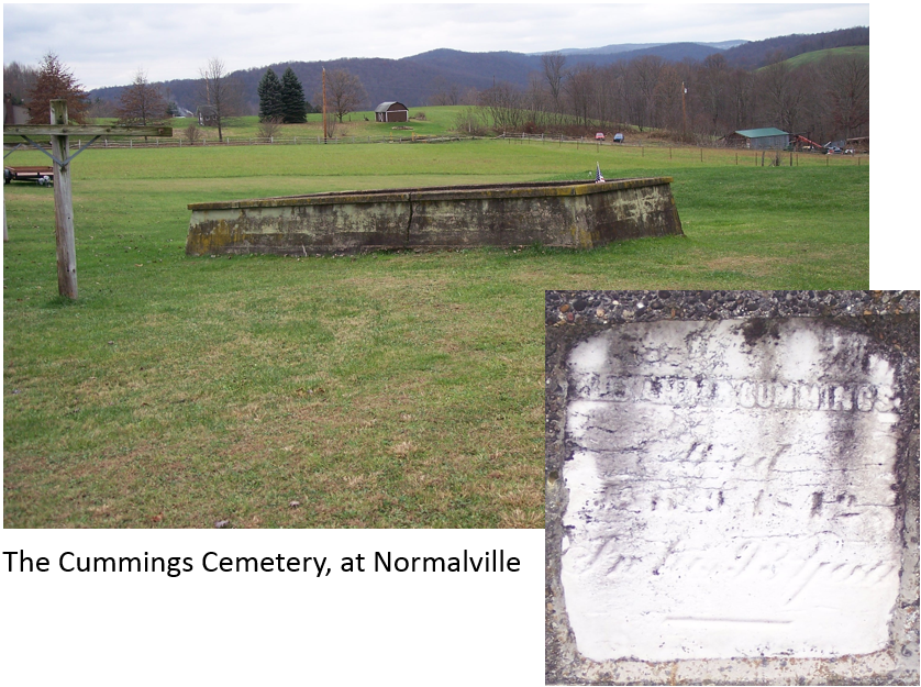
The Cummings farm
Alexander Cummings was an early settler along the Turkey Foot Road. His farm was just south of Normalville.
He was buried on the home place, along Route 381 at 39.99007, -79.446723, on property he had surveyed in 1788 along the Turkey Foot Road. His tombstone is cemented into the wall that surrounds the little cemetery.
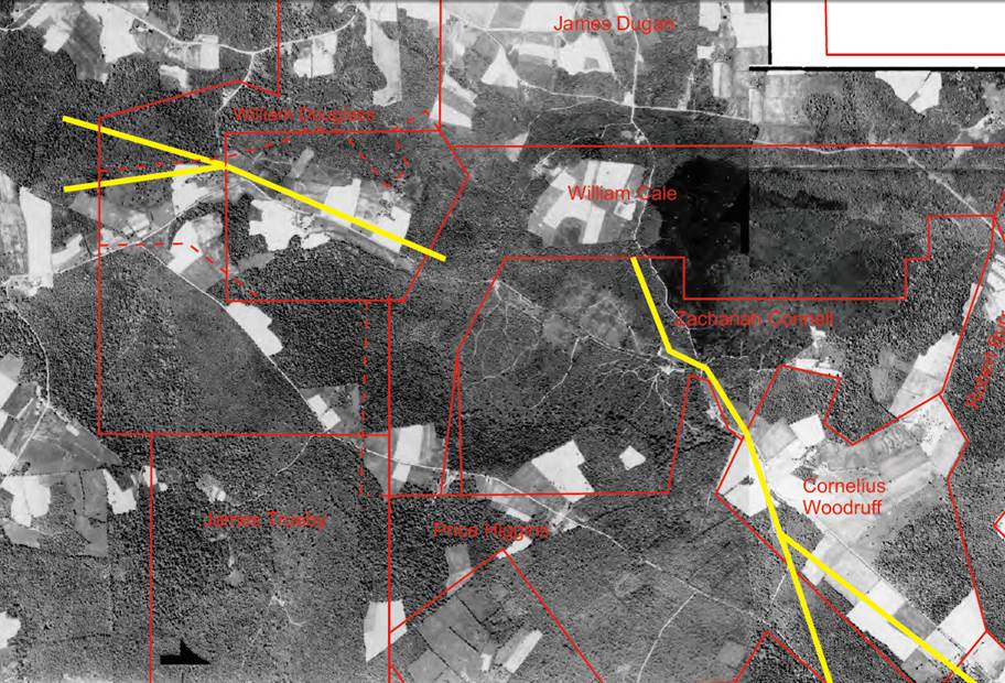
Normalville, in 1939 and 1858
Around 1858, Judge Veech wrote a book called "The Monongahela of Old". That book says the Turkey Foot Road crossed the Clay Pike (now Route 653) at Springfield, which is now Normalville [39.99529, -79.445955]. Springfield is an old name for Normalville. This is a 1939 photograph and an 1858 map. The unusual parallel routes north of Normalville merged into a single route by 1939. The left-hand route headed toward Cornelius Woodruff's farm. It's probably the Turkey Foot Road.
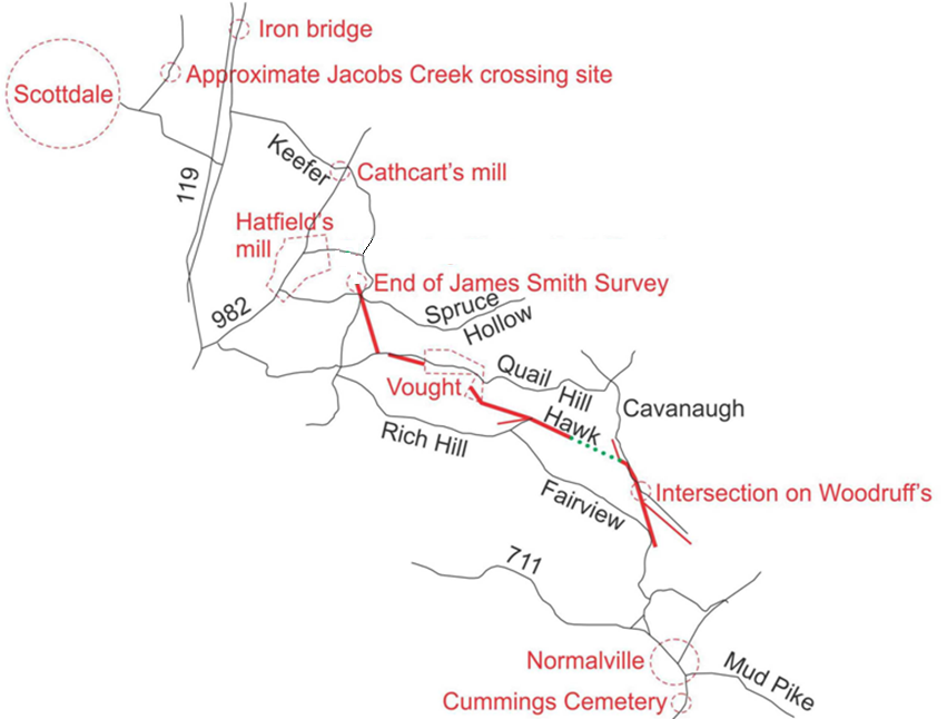
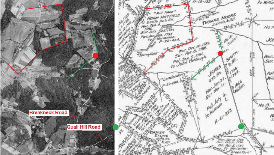
The route across northern Fayette County
This shows the known parts of the road across northern Fayette County.
Thick red lines are the route shown on early surveys. Green dots show sections identified with aerial photographs. Woodruff's place is at the intersection of Gas Well Road and Cavanaugh Road. After that, the route followed Hawk Road. After Hawk Road, the route veered north, serving as the antecedent to part of Quail Hill Road. The road turned north on the Smith survey, and headed toward Cathcart's mill at Wooddale.
Cathcart's mill was located at the intersection of Keefer Road and Route 982. From there, the Turkey Foot Road followed an unknown route to Jacobs Creek. The fording site was west of Route 119, near Scottdale.
A 1969 newspaper says the Turkey Foot Road crossed the Catawba Path on Walnut Hill. That's where Valley View Drive terminates on Kingview Road. I don't know for sure if this is a reference to the same Turkey Foot Road.
The 1784 route
This picture was taken from the 1794 Price Higgins warrant. This is looking north along the Turkey Foot Road. The 1788 Woodruff survey begins near the house on the ridge. The 1788 route of the Turkey Foot Road correlates to Gas Well Road and Cavanaugh Road between 40.025881, -79.456 and 40.033858, -79.459552.
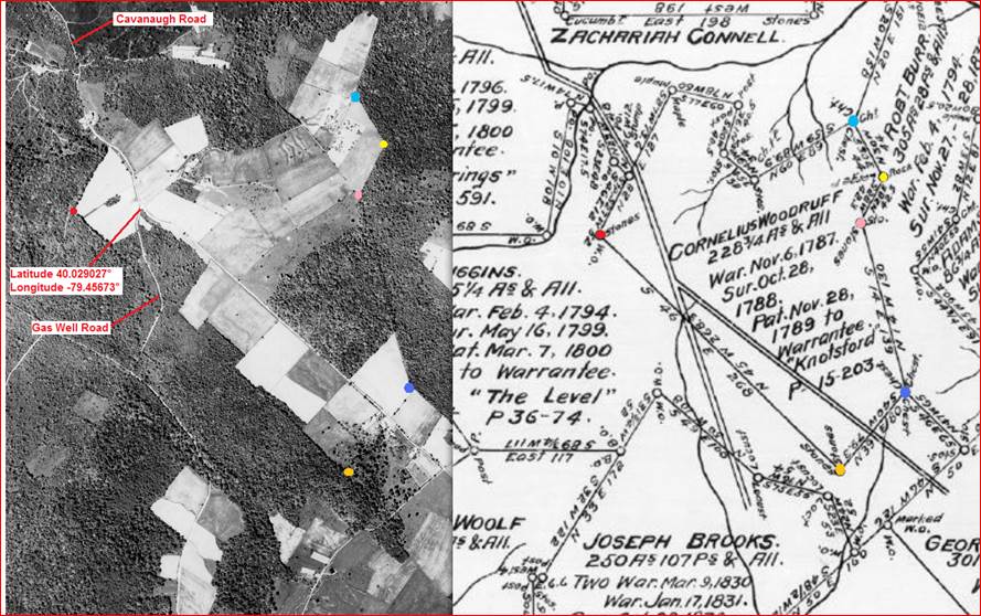
Eureka! Finding Cornelius Woodruff's farm
This compares the 1788 Woodruff survey to a 1939 image. It proves that Gas Well and Cavanaugh roads are the roads on Woodruff's survey. The colored dots show the matching corners of the property.
I had a really tough time finding this property. I ended up triangulating from three distinctive locations on Indian Creek.
The current intersection on Cornelius Woodruff's 1788 farm
Ernie Schultz lives here, on part of the old Cornelius Woodruff farm, which is the only named Fayette County landmark along the Turkey Foot Road on the 1792 Reading Howell map. Ernie's spring probably served Woodruff's house in 1788. Cavanaugh Road is in the foreground, and Gas Well Road goes to the right. They are the 1788 Turkey Foot Road. The intersection is located at 40.029027, -79.45673.
Beyond the fork, Cavanaugh road is displaced to the left from the old 1788 road to Jones Mill. The old sunken roadbed went through Ernie's yard. Ernie found a coin from the early 1800s in the old roadbed.
When I was trying to find this intersection for the first time, my GPS unit quit, and I got lost. I spotted someone chopping firewood in a field, and asked for directions. I told the guy I wanted to take some pictures at the intersection. He asked "Why?" It turns out I was talking to Ernie Schultz, who lives right at the intersection.
Ernie had an interest in the Turkey Foot Road, but didn't know where it was located. He was surprised to learn that he lived on an important landmark along the road.
Some of the fields on Cornelius Woodruff's 1788 farm
These are the farm buildings on the Woodruff property. The farmstead has been there awhile. It used to have a log spring house.
This overlay proves that the route was the antecedent to Hawk Road
This is a warrantee survey map superimposed on a 1939 image. The map is sized to match the Woodruff farm, at the lower right.
Yellow lines represent the roads shown on early surveys. The left-hand set of yellow lines prove that Hawk Road is the Turkey Foot Road. Disregard the slight offset between the yellow line and Hawk road. That's just an artifact of the non-orthorectified nature of the image.
If you look closely, you can see the now-abandoned route in the gap between the yellow lines. The Turkey Foot road followed a west-northwest course between 40.033858, -79.459552 and 40.042318, -79.482286. Part of this section of the old road survives as Hawk Road. From the last set of coordinates, parts of the old route can be traced up to the quarry.
When I first turned onto Hawk Road, I stopped to talk to a man named Jessie Nicholson. I introduced myself, and said that I was researching an old road that ran through the area. Instantly, he said "The Turkey Foot Road". He knew the name from local surveys. In his younger days, he walked the abandoned road. He knew that it ran between Cavanaugh Road and Quail Hill Road. I never walked it, but I figured it out from old surveys.
The abandoned route heads west from Cavanaugh Road at Robert Fulton's yard.
This was taken north of Woodruff's survey, at 40.033858, -79.459552. It shows where Hawk Road came out on Cavanaugh Road. The water in the sunken roadbed is from a culvert under Robert Fulton's yard. The abandoned road continues on to Hawk road. It goes near the doghouse that can be seen in the background. This section was still open when Robert's father had the farm. When I visited Robert, he already knew it was the old Turkey Foot Road.
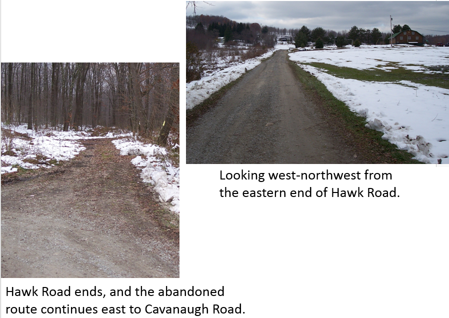
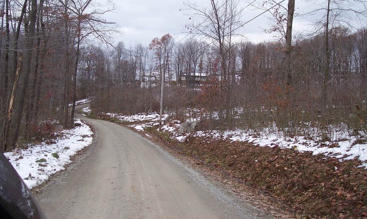
Hawk Road
Both of these pictures were taken from the eastern end of Hawk Road [40.039164, -79.474801]. The left-hand picture is looking east-southeast. It shows the abandoned roadbed going into the woods, and heading toward Cavanaugh Road.
Jacob Frelick took out a warrant for property just east of here in 1784. It became the subject of a lawsuit against Isaac Meason in 1804. The plaintiff didn't know where the property was, and accidentally sued the wrong guy. Meason won on a technicality because the plaintiff failed to present a survey. If the plaintiff had known where the property was really located, he could have sued William Cale, who warranted the same property in 1794.
The right hand picture was taken looking generally west-northwest. It shows a surviving section of the Turkey Foot Road.
Michael Entlich was keeping a tavern on this section of road in 1796. He already had 70 acres cleared, along with a log house and barn. By 1802, a shoemaker named Welsh was also living on this section of road.
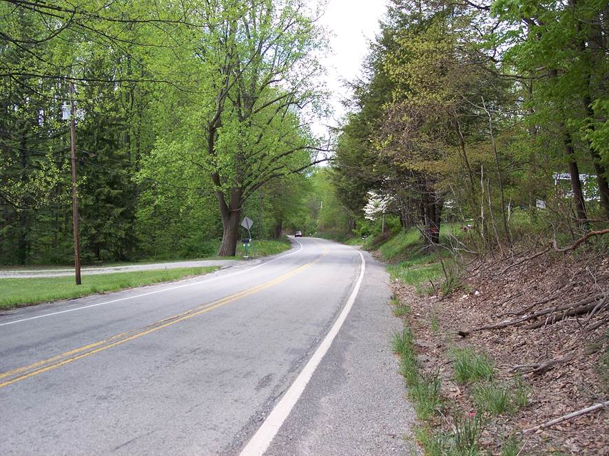
This part of Quail Hill road is the Turkey Foot Road
This is immediately west of the 1796 property of John Vought, looking west-northwest. This part of Quail Hill Road is the modern alignment of the old Turkey Foot Road. Quail Hill road follows the 1794 route from about 40.053176, -79.508657 to about 40.054227, -79.519601. After this, the Turkey Fooot road turned northwest toward Wooddale, crossing over Breakneck Road.
Locating the route, orienting from Hatfield's property
This is a 1939 image on the left, and a warrantee survey map on the right. The red and green boundaries are the Hatfield and Harbough properties. These distinctive properties were used to orient the image to the map. The 1786 Hatfield property is the Pleasant Valley Country Club on Route 982 [40.068799, -79.540884]. Back in 1784, it was thee site of Hatfield's mill. If this were a better-quality image, you could see the mill race, and match it to the race on Hatfield's 1786 survey.
The red and green dots mark the 1794 Turkey Foot Road across the Smith survey. A much more level shortcut route, in the form of a deeply sunken road, follows the ridge, east of the route shown here.
The 1780 deed to Hatfield for the property at the present-day Pleasant Valley Country Club describes that property as being on both sides of the Turkey Foot Road. Since the military road was cut in 1779, the reference to the Turkey Foot Road on the 1780 deed seems to be a concrete reference to the original military route. Where it crossed the Hatfield property remains a mystery.
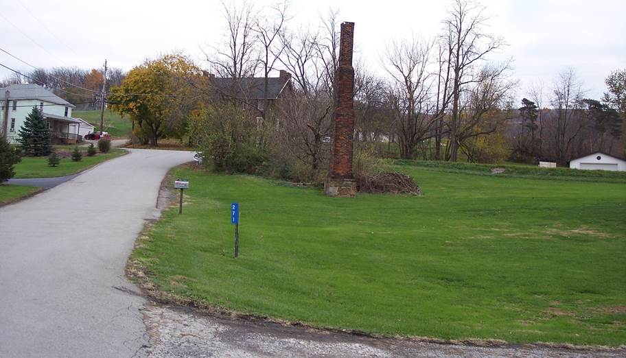
The Turkey Foot Road ran past Cathcart's mill, at Wooddale
This is the general area where Cathcart's mill was located. The chimney [40.088095, -79.527446] is part of a mill from the late 1800s. Parts of the mill race still survive.
John Cathcart warranted this property in 1787, and patented it in 1788. Keefer road is on the left. Pleasant Valley Road is at the intersection in the background. Veech's circa-1858 book says the Turkey Foot Road passed Cathcart's mill. The exact route is unknown.
The approximate fording site across Jacobs Creek
This is the general area where the Turkey Foot Road crossed Jacobs Creek, into Westmoreland County. Because of intervening swampy ground, this is the first good fording area west of Route 119. This is where Overholt Lane crosses Jacobs Creek [40.105404, -79.569327].
Two general locations of the road are known in Westmoreland County, based on the Whiskey Rebellion travel journal of Dr. Wellford. Dr. Wellford stayed overnight with a Mrs. Woodrow on the night of November 23, 1794. From the location where the northern end of Kendi (Fenton) Road terminates on Route 981 [40.145394, -79.574807], Mrs. Woodrow's property extends south one mile on both sides of Kendi (Fenton) Road. The route of the Turkey Foot Road across the Woodrow property is unknown.
The most northerly location of the Turkey Foot Road that is known with any precision is at Ruffs Dale. Dr. Wellford describes turning right from the Glade Road onto the Turkey Foot Road, and then traveling four miles to Mrs. Woodrow's. A November 8, 1780 deed (recorded May 22, 1783) describes John Emerson's sale of property located on Lick Run and the Turkey Foot Road. Lick Run is now Buffalo Creek. The Emerson property is located on the Glade Road, just a few yards west of Buffalo Creek, and a bit of it covers the southernmost part of Ruffs Dale. This means that the 1779 military route of the Turkey Foot Road crossed the Glade Road in the general vicinity of 40.172281, -79.609201.
From this last known point, an educated guess would be that the Turkey Foot Road merged with Braddock's road in the general vicinity of Hunker, Pennsylvania. For orientation purposes, Braddock's road was the antecedent to Preacher Street, which runs from 40.196628, -79.610697 to 40.198107, -79.616281.
The knowledge that the Turkey Foot Road passed through Ruffs Dale helps to explain why the Jacobs Creek fording site that Veech describes is so far west. The fording site allowed a shorter, more direct route, avoiding the meandering path of Braddock's road in the Mount Pleasant area.
L. Dietle

Return to the Korns family genealogy home page
