Return to PART ONE of the Turkey Foot Road tour
Near Pocahontas, the 1785 route survives as a trail
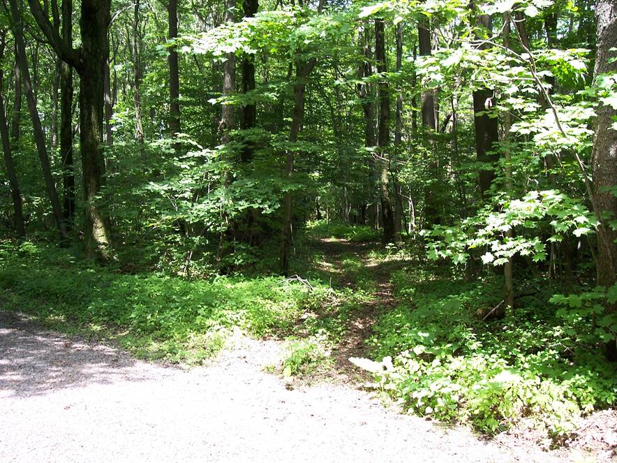
At approximately 39.724415, -78.940319 the 1785 route crossed the Greenville Road. From there, the old road was typically located no farther than about 600 to 1,000 yards west of the Greenville road. It joined the present route of Greenville Road east of the Greenville Lutheran Church, right where Red Dog Road terminates. Along the way, the 1785 route crosses Hemlock Lane at 39.731028, -78.952056, and crosses Murray Road at 39.736333, -78.960972. This photo shows where the Turkey Foot Road crosses Hemlock Lane. This trail matches the route shown on a 1785 survey and a 1939 aerial photo. Except for the size of the trees, this shows what the Turkey Foot Road looked like in the old days on level ground.
Where the old route joined the Greenville Road
This is looking southwest from Greenville Road. The 1794 road ran between the intersection sign [39.748357, -78.970655], and the corner of the field behind the sign. The Greenville Road follows the old route west from this location to 39.748671, -78.998512.
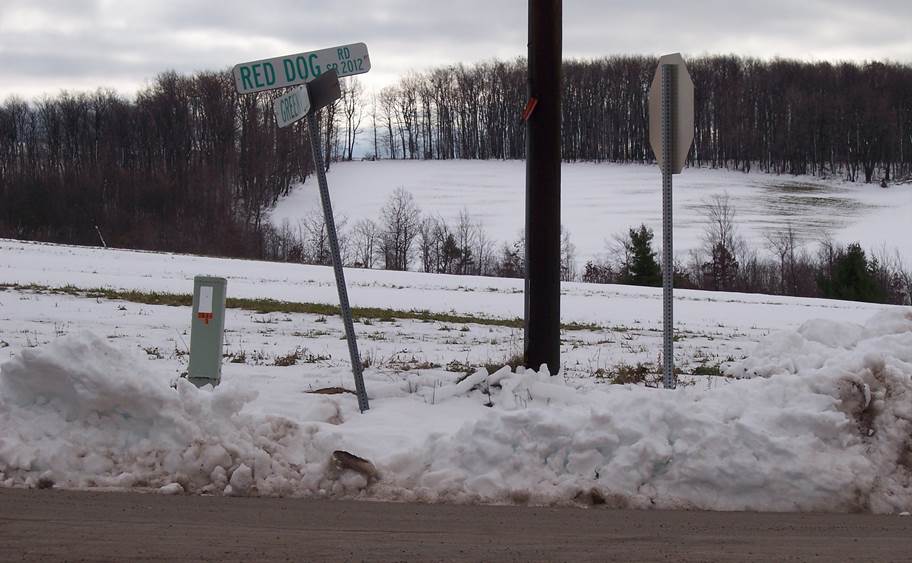
Where the 1819 route departs from the Greenville Road
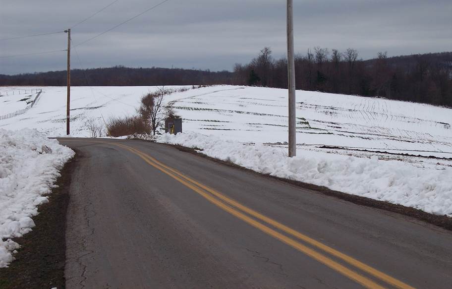
This is Greenville Road, looking west to 39.748671, -78.998512, where the modern road turnns sharply southwest toward the Greenville gap. In 1819, the Turkey Foot Road followed the fencerow shown here to 39.748019, -79.003903, then passed through 39.749111, -79.014455 as it headed toward the Alllegheny Mountain. The fencerow is visible on present day satellite imagery. The 1700s route was farther north, crossing Haldeman's "Camp Misery" tract, parting ways with the 1800s route east of the Greenville Lutheran Church [39.751279, -78.990827]. Both routes crossed the Allegheny Mountain at the same point.
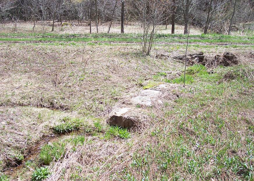
A stone culvert, on the east side of the Allegheny Mountain
This a culvert from the Turkey Foot Road. It is located a few hundred yards east of the crest of the Allegheny Mountain, at 39.741096, -79.037578. It aligns with a variation of the Turkey Foot Road that enters the field from the east.

This isolated farm is located back a long lane, one mile north of where the Greenville road passes through the Greenville gap. It used to be right on the main road: The Turkey Foot Road.
Straight down the west side of the Allegheny Mountain
This is the deeply sunken road going straight down the west side of the Allegheny Mountain from 39.742317, -79.044017, and enters a field at 39.7475, -79.050850. The road had had to go straight down the mountainside, to avoid rolling wagons over. Despite this precaution, there was a fatality on this section of road as a result of a runaway wagon. The wagon driver who was killed was the son of Douglas Baker, who surveyed Salisbury.
The rocks in the foreground were knocked there by a bulldozer. Apart from these rocks, the roadbed is completely rock free. The bulldozer was used to make a private road that crosses the old roadbed.
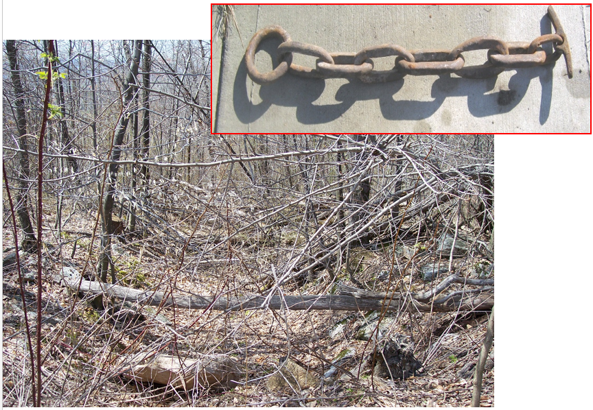
The gizmo at the upper right is a "rough brake" It was used to lock a wagon wheel when going down mountainsides. If you didn't have a rough brake, you tied a treetop to your wagon to provide extra drag.
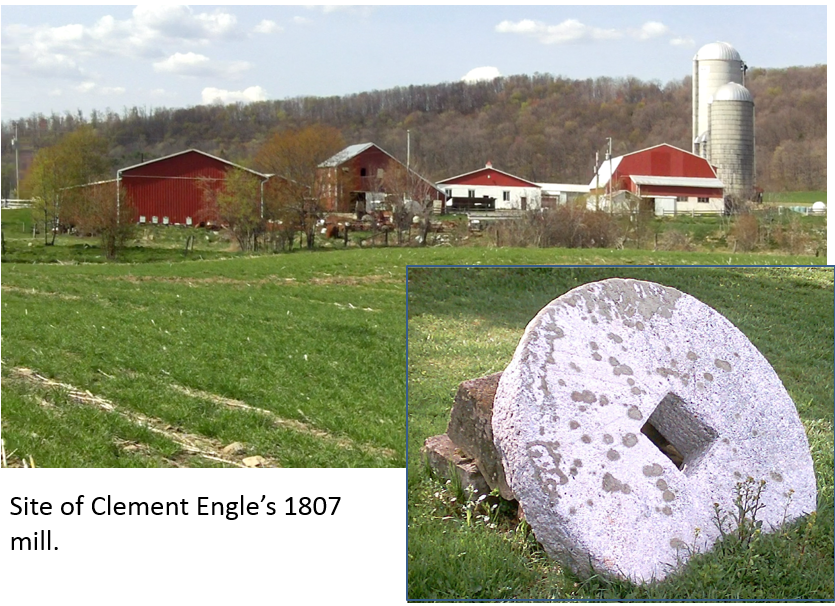
The road ran past Clement Engle's mill
West of the Allegheny Mountain, the road passed Clement Engle's 1807 mill [39.752882, -79.061453]. The mill was destroyed by fire in 1927.
Lowry brick house
After passing Engle's mill, the Turkey Foot Road passed the circa 1845 Lowry brick house [39.749924, -79.067466].
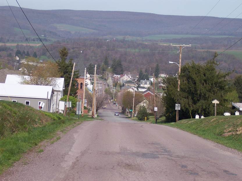
Ord Street, in Salisbury, is the Turkey Foot Road
This is looking west into Salisbury, along the Turkey Foot Road. Negro Mountain is in the background. This area was settled very early. The Turkey Foot Road was routed through here in 1779 to obtain forage from the settlement. One of the settlers was my ancestor Peter Livengood, who came in 1775.
An 1809 log church was located at the old cemetery on the right [39.752332, -79.077313].
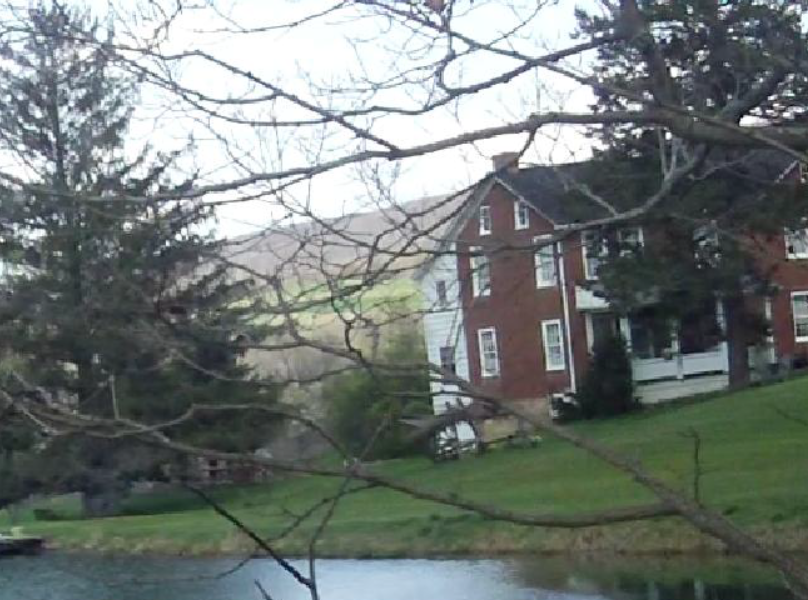
Salisbury, Pennsylvania
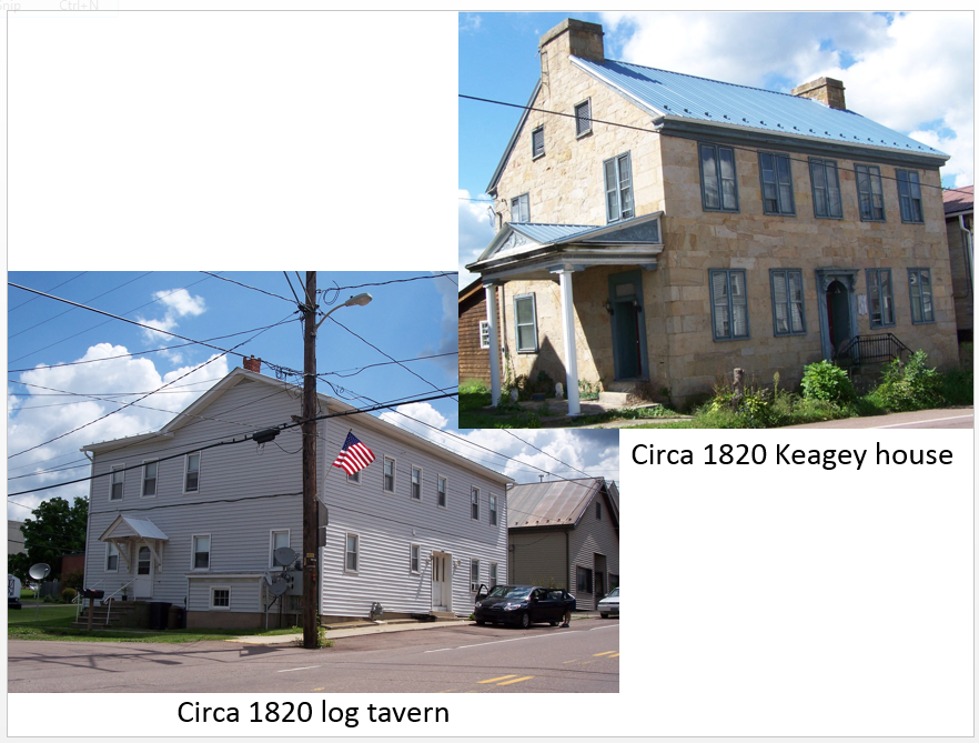
These pictures are from Salisbury. According to tradition, the log portion of the house on the left [39.753205, -79.08261] dates from 1820, andd was an inn along the Turkey Foot Road. One of my ancestor John Markley's sons founded the town in 1794, and another retired in this house.
The stone house at the upper right [39.752933, -79.082532] was built along the road around 1820 by John Keagey. He stole a wagon-load of merchandise, and was caught selling the goods at his store. He died shortly after being caught. People assumed it was suicide by poison. Because of this, they refused to bury him in the church graveyard.
The route to the fording site in Salisbury looks like a ditch
The ditch in this picture is actually the Turkey Foot Road. This [39.754059, -79.089152] is where it turned to the Casselman River fording site. This sunken road still shows up as an abandoned street on present day town plats, and is visible on satellite images.
That's Harry Ringler, Sr. in the picture. He taught me the traditional route variations in Somerset County. Harry seems to know everybody. He was able to take me on private property to study landscape scars. Harry's son is a cartographer for Somerset County. He provided old maps that helped to pinpoint the Somerset County route.
The Casselman River fording site at Salisbury
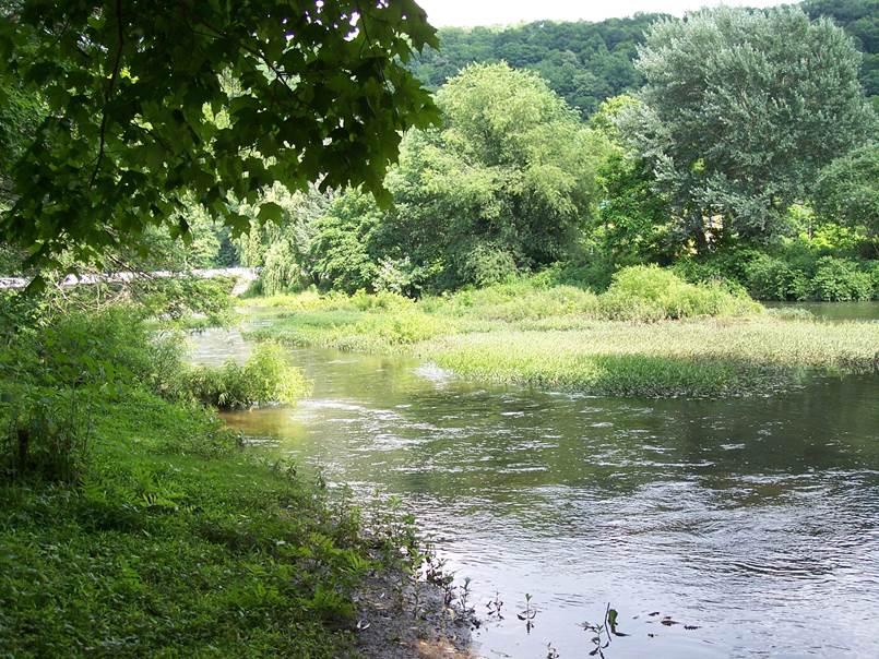
This is where the road forded the Casselman River. It was also the site of an Indian Village. Harry Ringler found a bunch of arrowheads here when he was growing up. This is the "Long Field" described in history books. When the first settlers arrived, it was an abandoned Indian field. The fording sites were located between 39.752609, -79.093355 and 39.752271, -79.093044, and are visible on 1939 aerial photos. The probable reason the ford was in use so long was so that livestock could drink while crossing.
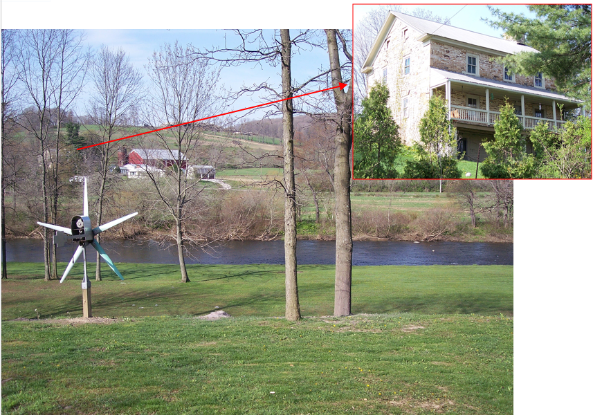
The 1809 Beachey house [39.751015, -79.094927] is just barely visible on the left. It is also shown in the upper corner. The 1700s Turkey Foot Road ran along the left (southern) flank of the hill in the background, following a route similar to present day Springs Road (Route 669) between approximately 39.748675, -79.098194 and 39.742315, -79.122205. An earlier packhorse path passed on the right (northern) flank of the hill. William Tissue lived along that path, and entertained packhorse drivers. His home was located to the right of the barn, just past the end of the field. After Tissue's wife was murdered by a hired hand, he moved down the road to Turkeyfoot.
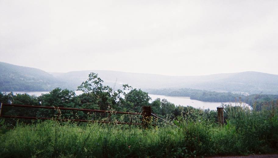
A view from the road at Winding Ridge, along High Point Lake
This picture of High Point Lake [39.779222, -79.217617] was taken from High Point Road, looking north. High Point Road is part of the earliest provable route. The lake was a swamp in the 1700s.
Green Road is still very primitive today
This is Green Road, looking east. This is a relatively good section of what was once known as the Turkey Foot Road.
This is a much more direct route, compared to the Mount Davis Road. Such directness was important in the days of animal powered transportation.
Don't try this road without a horse, or four wheel drive.
The 1879 Silbaugh Church on Fort Hill Road
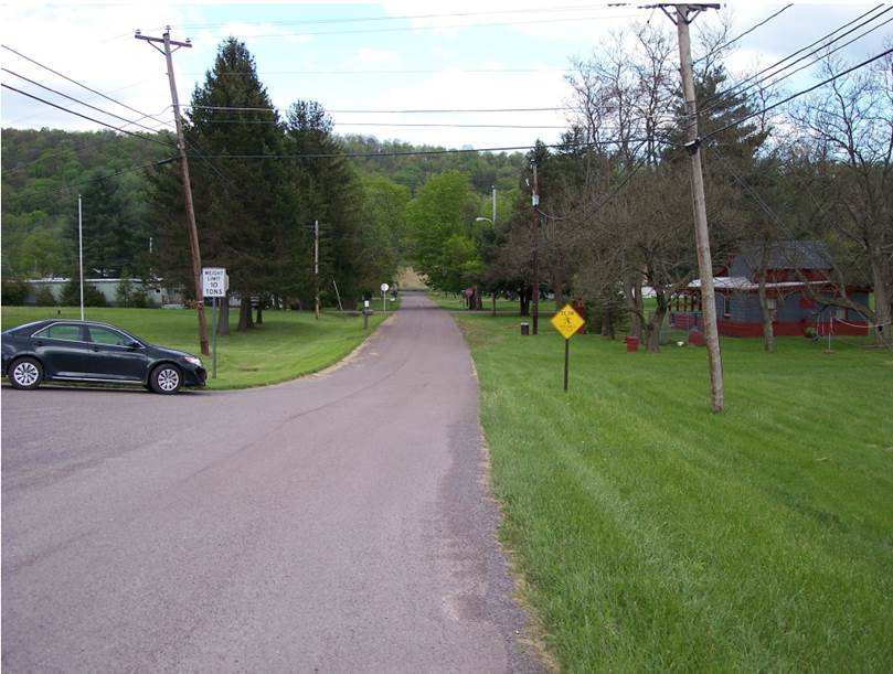
This is the 1879 Silbaugh church building, which is located at 39.786498, -79.291447. It is located along a surviving part of the Turkey Foot Road, but it is called the Fort Hill Road today. The congregation was founded in the 1820s.
The 1700s route survives near Harnedsville and through Ursina
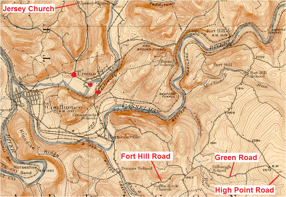
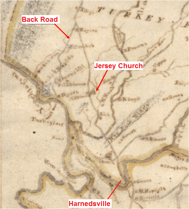
The name "Turkeyfoot" comes from the joining of three waterways at Confluence. You can see them at the left on this map. George Washington's papers contain the earliest known use of the name "Turkeyfoot". It is on the map from his 1754 journal. The surrounding area, was, and still is, known as Turkeyfoot. The Turkeyfoot Road got its name because it passed through the Turkeyfoot region. It didn't actually go to the site of Confluence.
High Point Road, Green Road, and Fort Hill Road are shown at the lower right. From about 39.780294, -79.239433 to 39.781931, -79.317094, High Point Road, Green Road, and Fort Hill Road follow the 1700s route of the Turkey Foot Road.
Surveys from 1786 and 1796 show the route through Ursina. That's what the red dots represent. Chestnut Street and Groff Road are surviving sections of the Turkey Foot Road. After Ursina, the road ran past the Jersey church, which is shown at the top of this image.
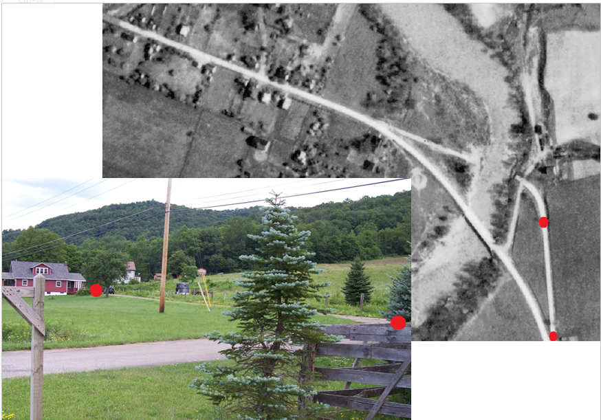
Covered bridge approach at Harnedsville
The street between the red dots went to a covered bridge at Harnedsville that crossed the Casselman River at 39.795278, -79.322737. The bridge was buillt at or near Green's fording site in 1815.
The first bridge cost 779 dollars. Part of the money was raised by local citizens. The bridge washed away in 1832, and was rebuilt for 900 dollars.

Site where a train hit a buggy in 1889
This is the railroad crossing between Harnedsville and Ursina, at 39.804382, -79.329140. Jeremiah Liston's buggy was hit by a train here in 1889. In the original jury trial, Liston was awarded 950 dollars. He had to go to the Pennsylvania Supreme Court to get his money.
The traditional fording site at Ursina
This is Laurel Hill Creek, at the traditional fording site in Ursina [39.815436, -79.330302]. Although the tradition is probably correct, the 1790s route is a few hundred feet west. Logs from the old settlers' fort were found near here when building a house.
Chestnut Street
This 2013 photo shows Chestnut Street in Ursina, Pennsylvania. It is the modern alignment of the old Turkey Foot Road that is depicted on the 1786 survey of Benjamin Pursell. The photo was taken from 39.815739, -79.335207 West of these coordinates, Groff Road is the old route.
The 1818 Melish-Whiteside manuscript map of Somerset County
This is an 1818 manuscript map of Somerset County. It is a good resource for understanding the route, and identifying early residents.
This fragment shows the route north from Harnedsville, and identifies the location of the Jersey Church. North of Ursina, tradition informs us that the route followed Jersey Hollow [39.830533, -79.333598], and this 1818 map shows it passing the Jersey Baptist Church [39.841019, -79.337536].

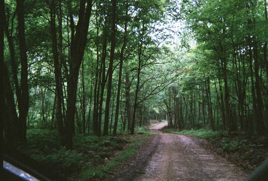
Jersey Hollow, north of Ursina
This is the road through Jersey Hollow, north of Ursina. Due to the constricted nature of the hollow, the original route had to be at, or very near, the modern route.
According to tradition, the Jersey Settlers passed through here around 1770.
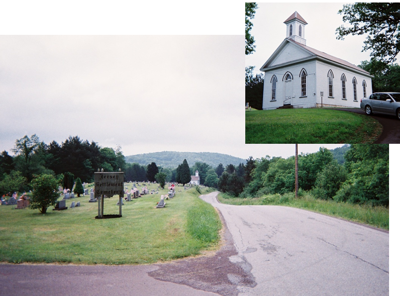
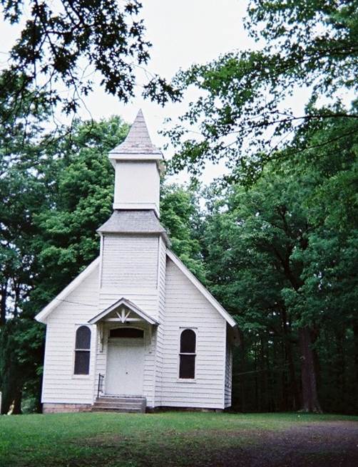
Oldest Baptist Congregation west of the Allegheny Mountain
The Jersey Church is the oldest Baptist congregation west of the Allegheny Mountain. The left-hand picture was taken from the north end of the new cemetery, looking south. The 1877 church building is visible in both pictures.
The congregation was founded on August 14, 1775. This proves that the Jersey settlers arrived before the military road was cut in 1779.
North of the church, between approximately 39.849683, -79.341931 and 39.876649, -79.354747, Jersey Hollow Road follows the route that existed in the 1785 to 1814 timeframe.
CONTINUE THIS PHOTO TOUR -- IN FAYETTE COUNTY
