
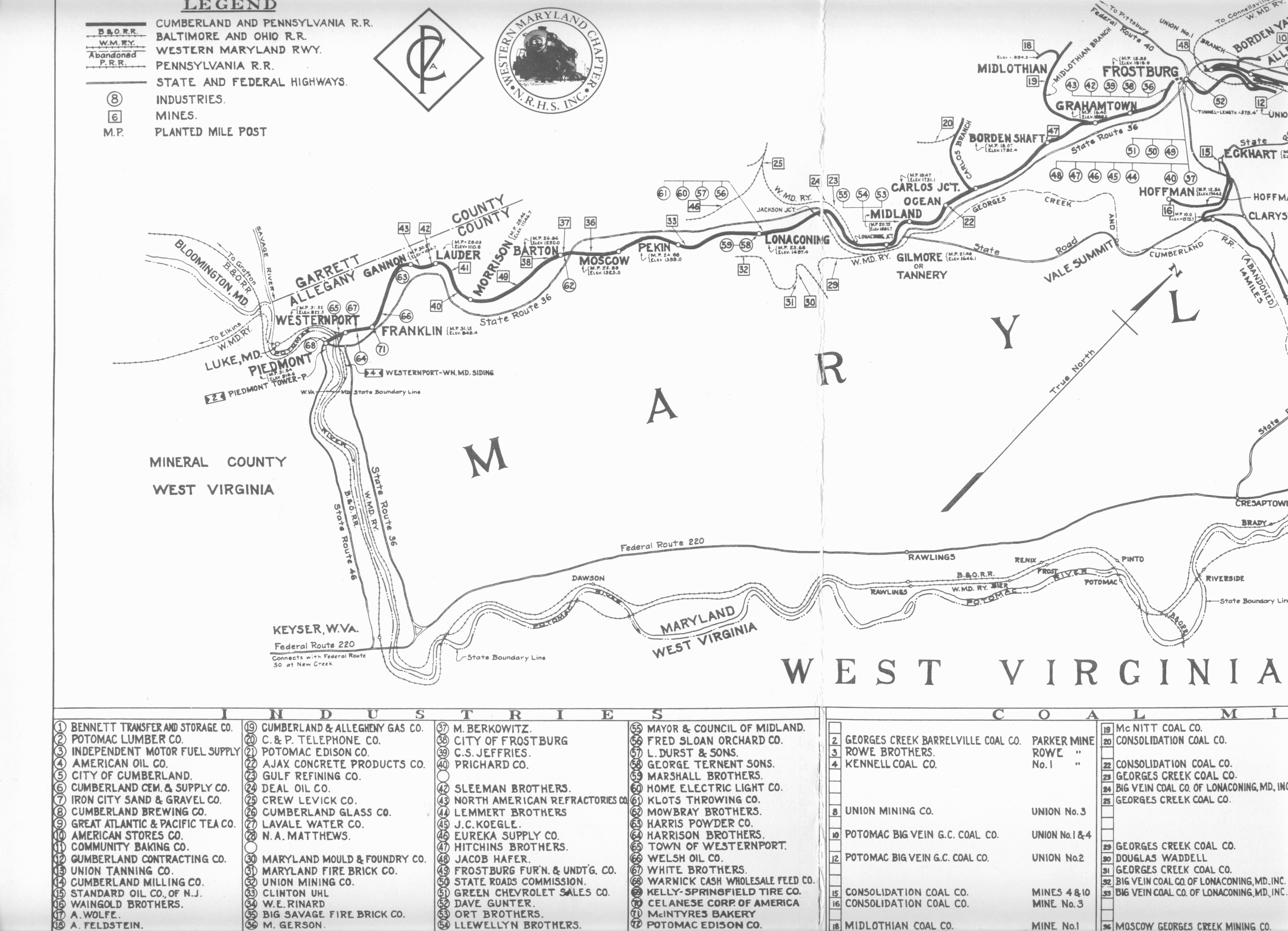
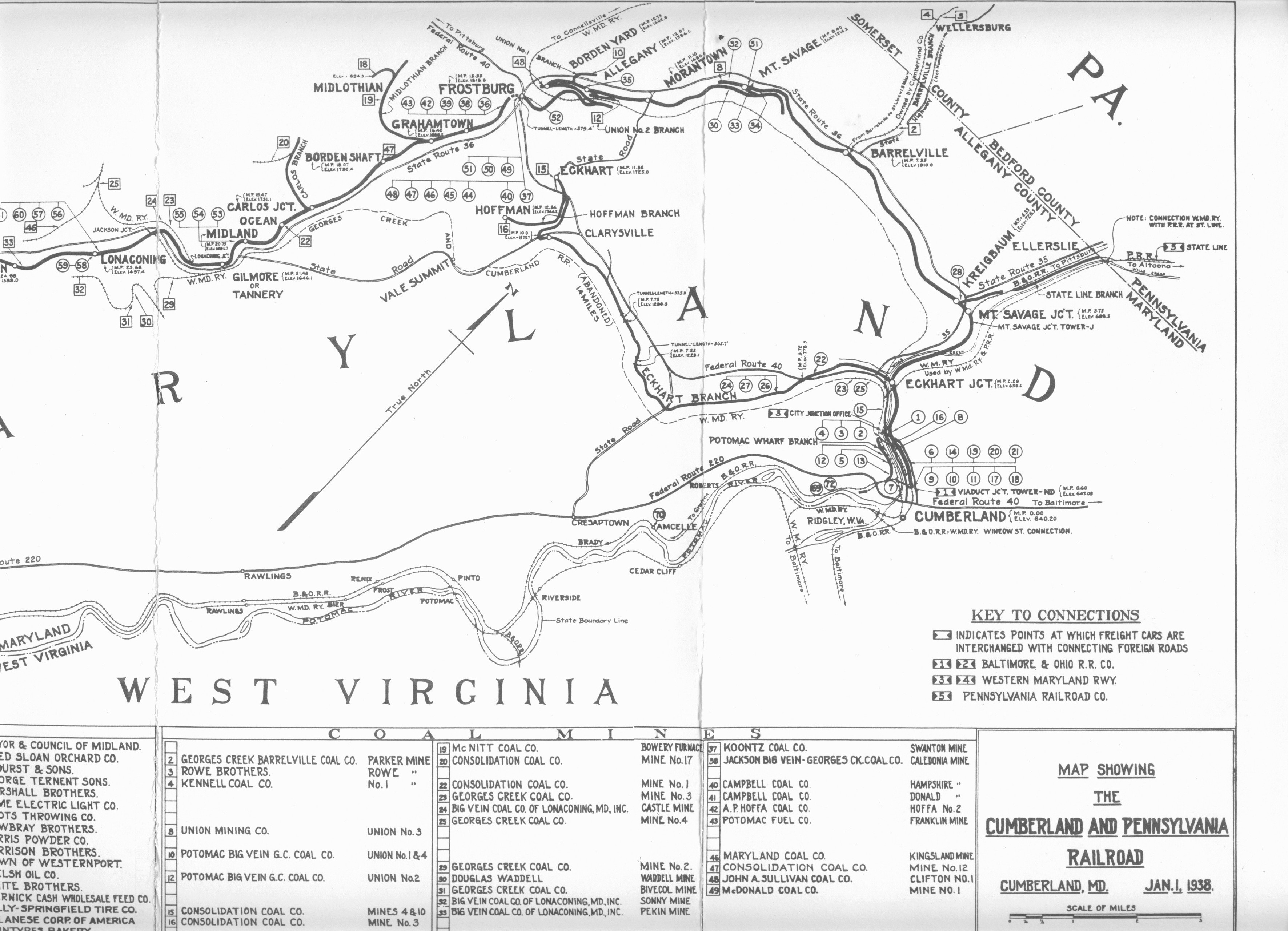
This 1938 map shows the configuration of the Cumberland & Pennsylvania Railroad in 1938. It was provided by Mike McKenzie. It is included here because it shows items of interest regarding the area near Wellersburg, PA and Barrelville, Maryland. Of particular interest is the fact that the branch Barrelville Branch railroad to Wellersburg is still being identified in 1938. This inclusion is curious, because that branch railroad appears to be abandoned in a 1939 USDA aerial photo.

The map also identifies some local area mines. Mike thinks, but isn't sure, that these mines may have been located as follows:
Mike indicates that the #4 Georges Creek Barrelville Coal Co. Parker mine is believed to have been near the bend in the Barrelville road, on the east side of the north branch of Jennings Run, behind the now-abandoned Curry Lumber Co. sawmill.
Return to the Korns family genealogy home page
