
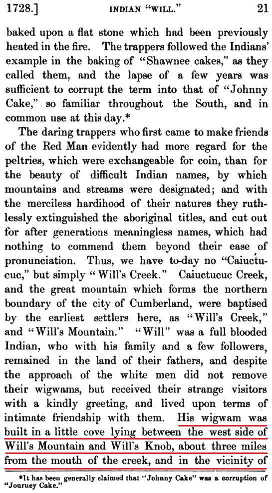
The 1878 book "History of Cumberland" by William H. Lowdermilk informs us that Allegany County's Will's Creek and Will's Mountain are named after an Indian named Will who remained in the area after the coming of the white man (see complete story below the map). Lowdermilk describes the location of Will's home as follows: "His wigwam was built in a little cove lying between the west side of Will's Mountain and Will's Knob, about three miles from the mouth of the creek, and in the vicinity of the rocky formation known as the "Devil's Ladder."

Korns.org contributor Mike McKenzie has long wanted to know where Will's cove is located. Through diligent effort, we can now state with high confidence that we have found the site that fits Lowdermilk's description perfectly. The site, which is a short distance northeast from Corriganville Maryland, is identified on the topographic map fragment that is included below. The reasons for believing this is the correct location are described below the map.

In the common vernacular of Lowdermilk's day, the word "cove" could be used to describe many things, such as an inlet of a body of water. Based on a visit to Cade's Cove National Park, another apparent vernacular meaning seems to have been this: a level area bracketed by hilly or mountainous terrain. We believe that is the definition Lowdermilk intended, and I was surprised to find that it was not in the 1895 Webster's Academic Dictionary.
Will's Knob isn't identified on any map that I have ever seen. While Lowdermilk doesn't say if Will's Knob is north or south of Cumberland, there is a distinctive knob that is three miles from the mouth of Wills Creek as the crow flies, as identified on the map above.
The key to the problem was identifying the location of Devil's Ladder. With diligent research, we have determined that there once was a striking rock formation called "Devil's Backbone" that was located at the site identified on the map above, just south the knob that is three miles from the mouth of Will's Creek. Click here for Devil's Backbone photographs and other documentation. The formation has long since been quarried away, and its location seemingly forgotten. Once the site of Devil's Backbone, and photographs of it, were located, it seems obvious to Mike and I that it was the location Lowdermilk described as "Devil's Ladder". It isn't unusual for tradtional local names to mutate over time, or to be called something slightly different by different people.
With the sites of Will's Knob and Devil's Ladder thus identified, the location of the "...little cove lying between the west side of Will's Mountain and Will's Knob... is obvious.
L. L. Dietle & Mike McKenzie, January, 2010
++++++++++++++++++++++++++++++++++++++++++++++++++++++++++++++++++++++++++++++++
The date of Will's death is not definitely known, but that event is supposed to have occurred about the close of the revolutionary war, or shortly thereafter. His remains were buried on the very top of Will's Knob, and the place of his sepulture is still pointed out to those who are curious enough to visit it. He left several children, who intermarried with white settlers, and their descendants lived near the Pennsylvania State line, on Will's creek, as late as 1810, but the last of them has now disappeared."

++++++++++++++++++++++++++++++++++++++++++++++++++++++++++++++++++++++++++++++++

++++++++++++++++++++++++++++++++++++++++++++++++++++++++++++++++++++++++++++++++

++++++++++++++++++++++++++++++++++++++++++++++++++++++++++++++++++++++++++++++++

++++++++++++++++++++++++++++++++++++++++++++++++++++++++++++++++++++++++++++++++
++++++++++++++++++++++++++++++++++++++++++++++++++++++++++++++++++++++++++++++++

++++++++++++++++++++++++++++++++++++++++++++++++++++++++++++++++++++++++++++++++
L. Dietle

