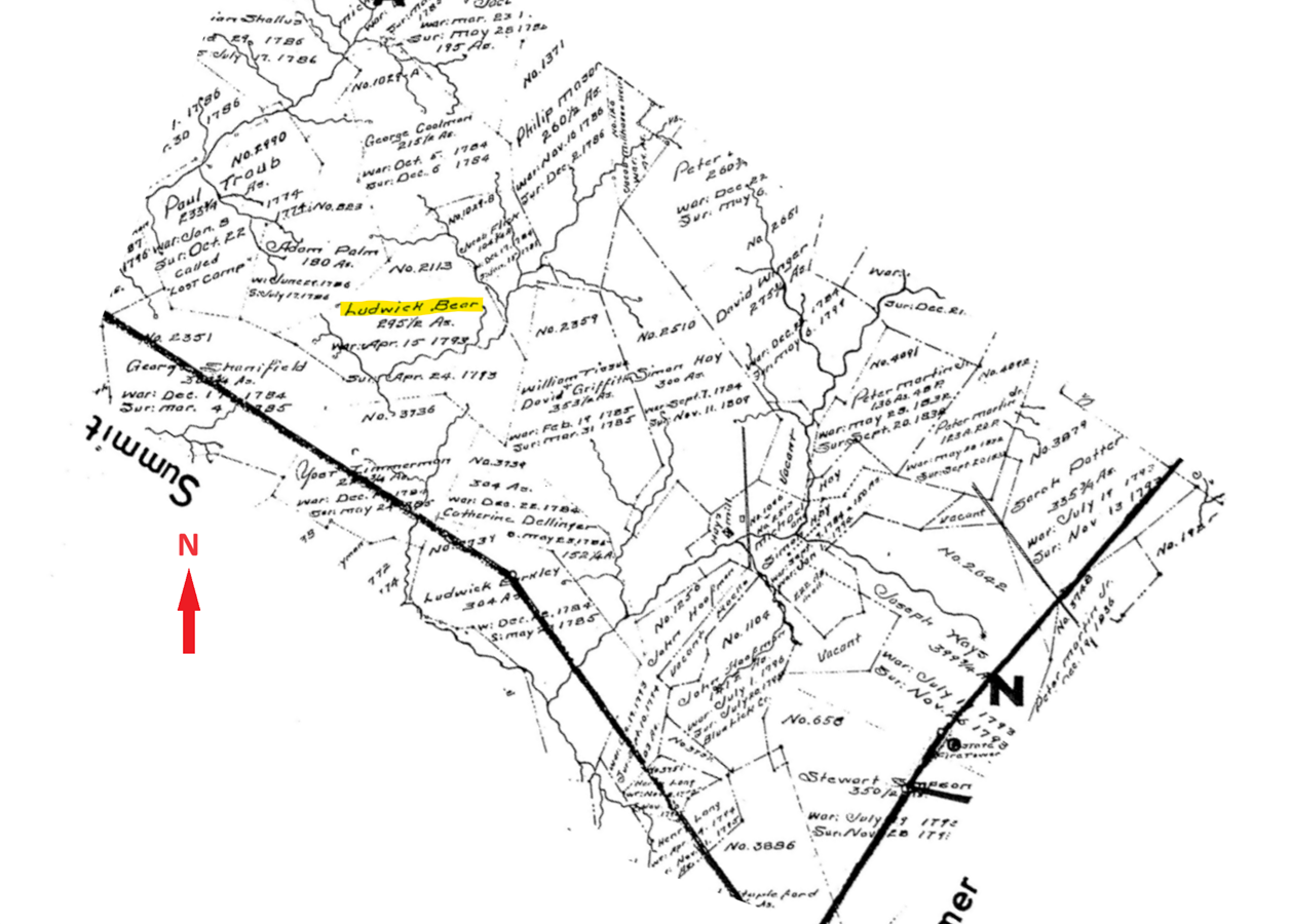
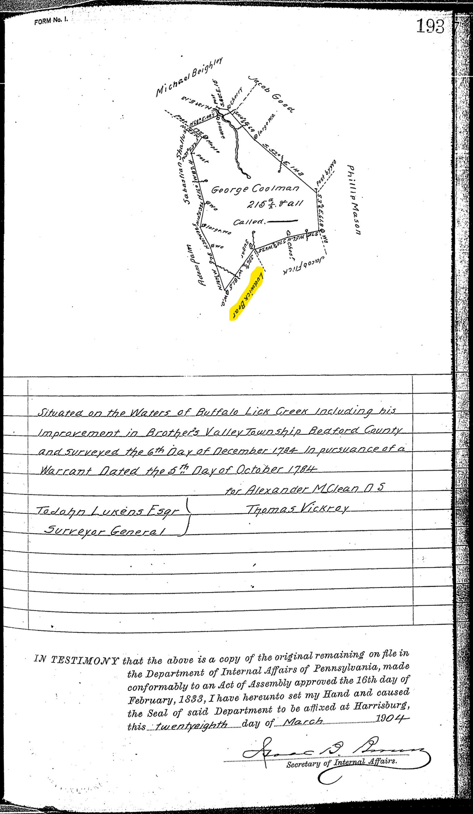
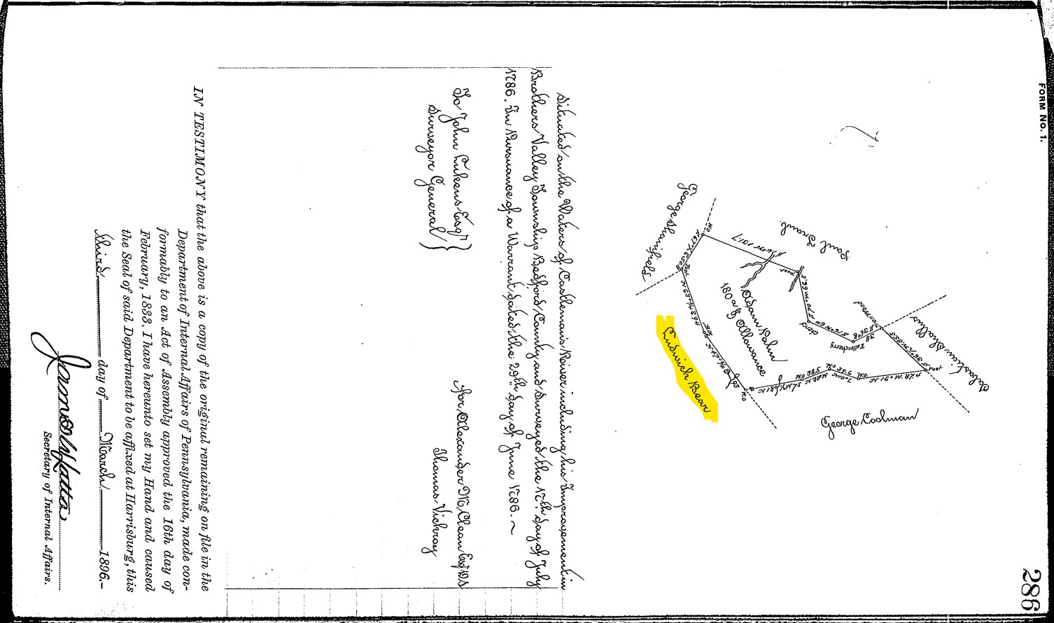
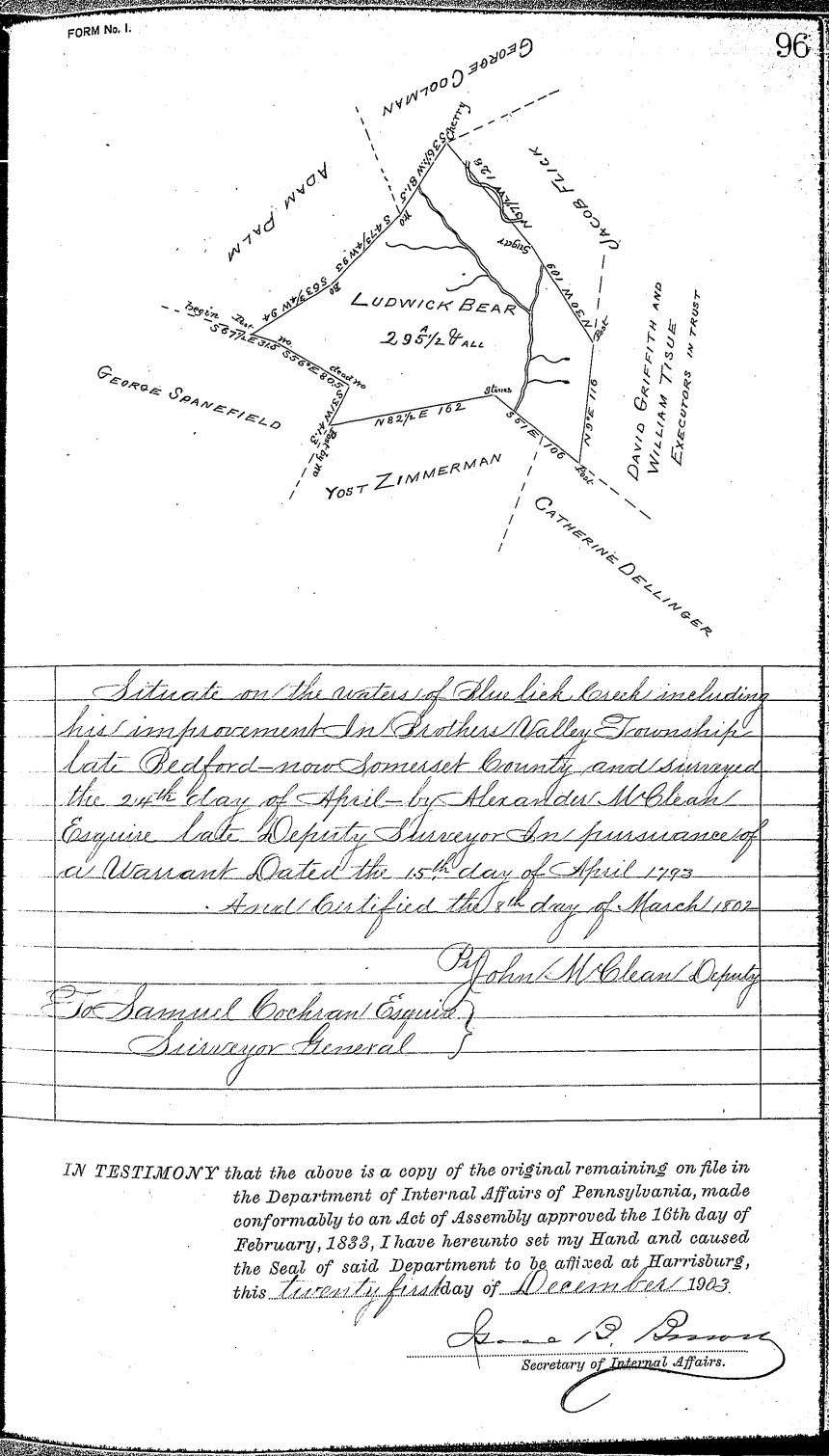
The following excerpt from the WPA Warrant Survey Map of Brothersvalley Township identifies the location of the property Ludwick Bear warranted in 1793. Because the December 6, 1784 survey (C-25 Page 193) of George Coolman identifies the adjoining Ludwick Bear property, we know Ludwick was already in possession of his Brothersvalley Township property in 1784. The 1786 survey (A-3 Page 286) of Adam Palm also identifies the adjoining Ludwick Bear property. The survey of Ludwick Bear's property is C-14 Page 96.
 In the following image, I tiled together four Somerset County parcel maps (Brothersvalley Township sheets 12, 13, 15, & 16) and then used yellow highlighting to identify the modern properties that correspond to Ludwick Bear's 1793 property survey. The stream and road that pass through the eastern part of the Ludwick Bear property are Blue Lick Creek and Blue Lick Road. I think you would be roughly in the middle of the southeastern end of the property at 39.86050407428859, -78.995574712991 on Blue Lick Road. Those coordinates are about 0.54 miles from, and generally south of, the intersection of Blue Lick Road and the Old Cumberland Pike.

Return to Ludwig Baer page
Go to the home page
