L. Dietle

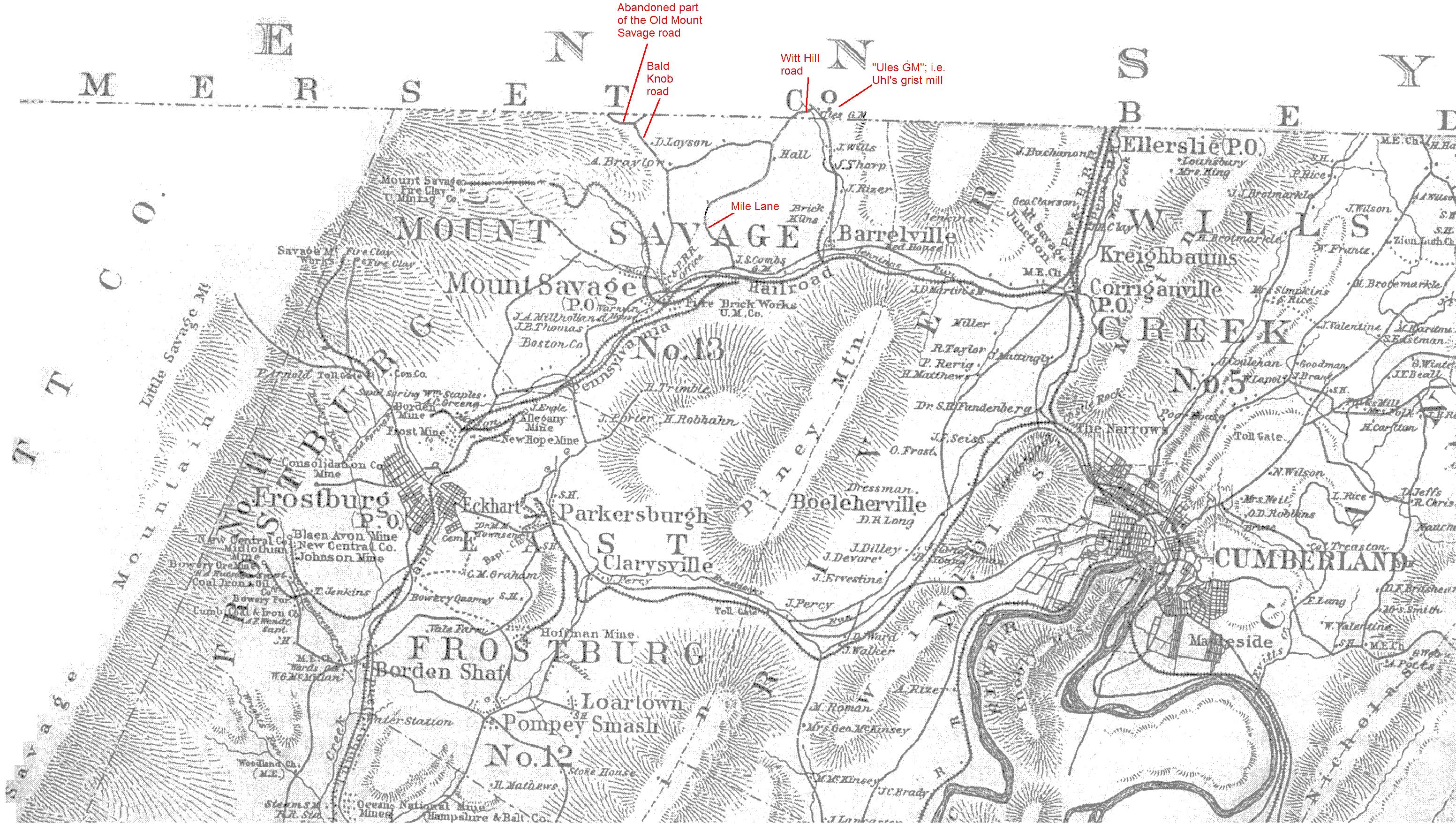
The 1875 map below was provided by local area resident Mike McKenzie. It has been annotated to identify some current and recent road names in the Barrelville/Mount Savage area. Click here to see an 1804 survey plat that shows that at least a portion of the present-day Bald Knob Road, in conjunction with the now-abandoned Maryland portion of the Old Mount Savage Road, formed the old Turkey Foot Road. The road that is now known as Mile Lane no longer extends down to Route 36 where it did in 1875. The 1875 map also shows that the mill that was identified as the Ule's Mill
on the 1818 Melsh-Whiteside map of Somerset County PA was still known by the same name in 1875.
L. Dietle